The Rangers have observed a
marked increase in skier traffic on the upper mountain in recent years. This has
coincided with a significant increase in accidents involving skiing. We are
compiling data in order find common errors that skiers make that get
them in trouble. We hope to use these cautionary tales to prevent future
accidents.
One constant observation that the rangers have made is that
the basic approach to risk management is often skewed in skiing parties. It is
often assumed that since skis spread one's weight out over a large surface area
then they are a safer method of travel on glaciers. This may be true for flat
valley glaciers but on the steep terrain near the summit the opposite is often
true. The extra weight and awkwardness of skis makes the endeavor more
challenging and requires more attention paid to risk management.
Another area of concern for rangers is the willingness of
parties to climb one of the standard routes to access a steeper, more remote
descent objective. This may be physically less challenging but it robs the
skier of the ability to assess conditions on the ski objective and to identify
hazards on the ascent. Dropping in to an unknown, unseen route automatically
increases the risk of the endeavor substantially.
Individuals considering a ski attempt on Mount Rainier
should possess significant previous experience skiing on glaciers and at
altitude. While no other Cascade volcano possesses the same degree of challenge
for the ski mountaineer, it is imperative to have experience skiing on other
peaks like Mount Baker and Mount Adams before coming to Mount Rainier.
Here are some considerations if you are planning a ski trip
on Mount Rainier.
Team Selection
This is
the most important factor to consider when planning a trip to Mount Rainier. The
vast majority of terrain on Mount Rainier can be classified as “no fall”
territory. Although ski falls may be common and insignificant in a ski resort,
all falls on the upper mountain are serious. Simply losing an edge can easily
cascade into an unstoppable slide into an open crevasse. Reverting to side-slipping
or falling-leaf technique, rather than linked turns, can help maintain control
of your ski descent.
If anyone
in your party has any doubt of their ability to safely ski the route, you
must be willing to communicate that and revert to appropriate roped glacier
travel techniques.
Successfully
completing a ski descent of Mount Rainier requires individuals and teams who
are competent in a broad spectrum of mountain skills. Mountaineering, glacier
travel, rope techniques, navigation, and expert-level downhill skiing skills
with a heavy backpack are the bare minimum.
Route Selection
There
is no easy way to ski from the summit of Mount Rainier. All routes feature
complex glacier travel, steep skiing, and long sections of no-fall terrain.
Commonly attempted routes include: Emmons-Winthrop, Fuhrer Finger, Kautz
Glacier, Success Couloir, and Ingraham Direct.
There
are many excellent ski descents on the mountain that minimize exposure to crevasses,
ice and rock fall, and high altitude. Descents of the Muir Snowfield, Van Trump
Snowfields, The Turtle, and Inter Glacier all serve as a nice introduction to
the challenges of skiing on Mount Rainier.
One Day vs. Overnight
Trips
An increasing
number of teams opt for single day attempts; these require exceptional
fitness levels. We see many teams that begin their attempt together but slowly
get spread out across the mountain. This is unacceptable. It is crucial that
team members remain within verbal and visual communication at all times. If one
party member needs to stop or descend, the group should do the same. Do not
leave anyone alone on the mountain. Consider a multi-day attempt so that you
can begin your summit attempt rested and focused for the strenuous day
ahead. Overnight trips also present better opportunities to time your
descent for optimal conditions.
No matter which strategy your party chooses you must register for your climb and pay the climbing fee. More information on that process can be found here.
Weather &
Avalanche Conditions
Since
professional avalanche forecasts are not issued during the summer months, snow
stability must be assessed by the team before entering avalanche terrain (most
of the upper mountain). Late season storms often deposit feet of snow and
produce slab avalanches. Even small amounts of snow spread out on the
volcano can rapidly drift into wind slabs.
When
signs of instability are present, the best course of action is to
descend immediately from your current location rather than trying to outsmart
the avalanche problem. It only takes a small amount of moving snow to
knock you off your feet and push you into places that have serious
consequences.
Snow
Surface Conditions
This is
probably the hardest variable to predict when planning a ski descent of
Rainier. Snow conditions vary widely across aspect and elevation. The upper
mountain rarely features smooth snow surfaces that could be defined as “good”
skiing – it is commonly “survival skiing” up high. The surface above
high camps is frequently a mix of breakable wind crust, very firm
wind packed snow, ice chunks, sastrugi, and refrozen snow. Expect to
ski “bad snow” for some or all of every descent.
Furthermore, it is rare that a ski descent does not require some down climbing. In many cases the decision to transion to crampons and ice axe for a short down climb can be a life-saving event. You must expect that you will need to take off your skis, rope up and climb down intermittently.
Just
because you’ve read reports of good ski conditions on south side routes, don’t
expect the same on other aspects of the mountain. The east and north sides of
the mountain are commonly weeks behind in the melt-freeze cycle transition into
corn snow. This means that routes like the Emmons and Fuhrer
Finger have vastly different conditions on the same
day. Don’t be afraid to walk downhill rather than skiing in difficult
conditions.
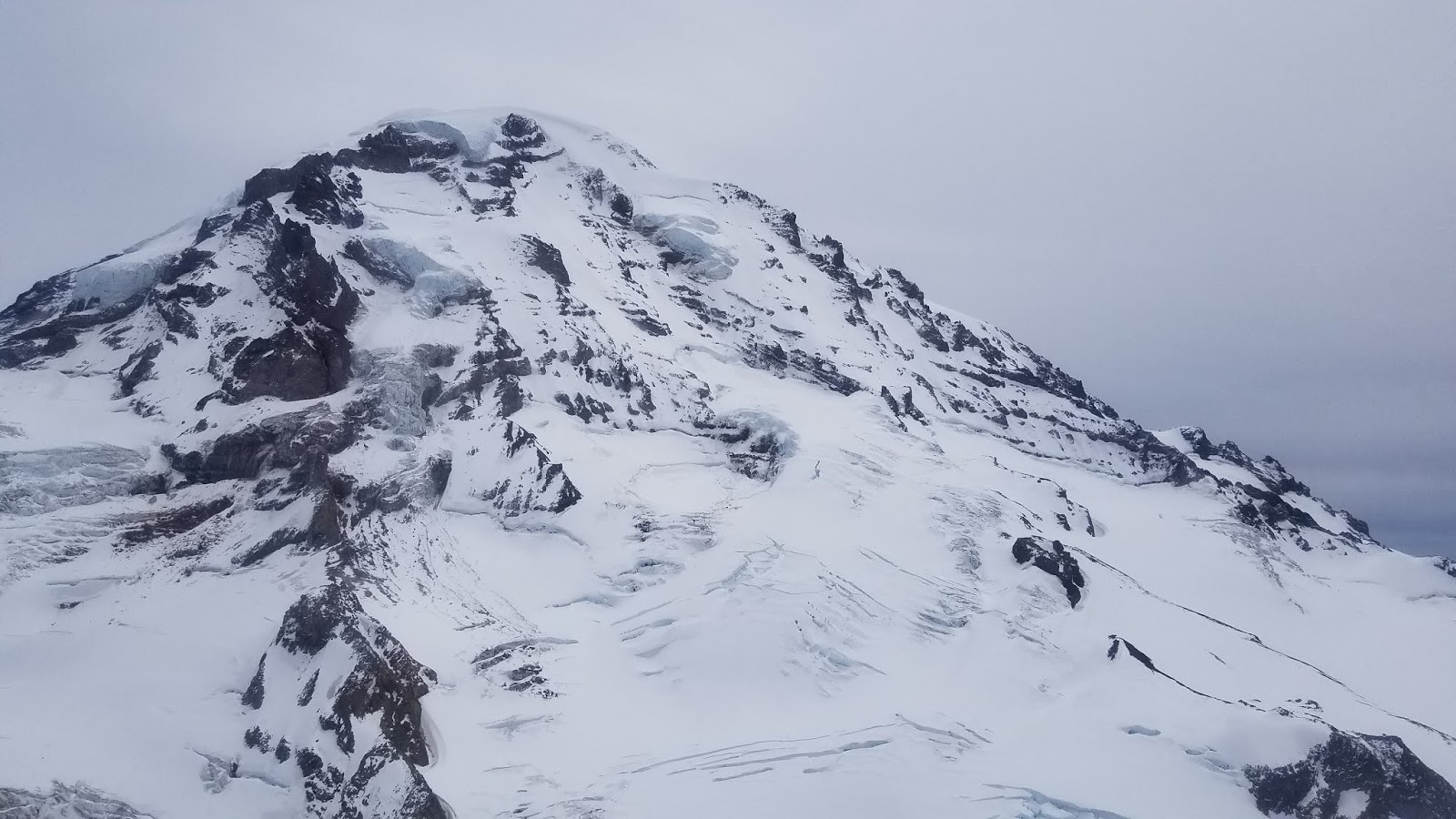
Glacier Conditions
As the
season progresses, all potential ski descents become more challenging as
crevasses open and more ice is exposed. The trend in recent years has been to
attempt ski descents earlier in the season to help mitigate these hazards,
though this brings increased risk of avalanches, challenging navigation,
and more hidden crevasses. Regardless of when a descent is attempted,
always ensure that you can see to the bottom of the slope you are on. Convex
rolls often hide crevasses on their downhill side.
All
parties on foot should be roped up to help protect against glacier hazards.
This means transitioning from skiing to booting (or skiing to booting) should
be done after roping up and spreading out the team. The greatly reduced surface
area of boots compared to skis greatly increases the likelihood of crevasse
falls.
Technical & Rescue
Considerations
All parties
must be competent in crevasse rescue. Every member should wear a climbing
harness at all times in the event of a crevasse fall. Carrying two ropes
affords a greater safety margin in the event that the person carrying the
only rope falls into a crevasse. Many crevasses are deeper than 100 feet, so
carrying two ropes per team that are each longer than 40
meters is recommended. Each party member should have enough supplies to
construct a rescue anchor, rappel into and ascend out of a crevasse, and execute
a haul system. All other mountaineering equipment should also be
carried, including crampons, ice axe, helmet, navigation, and survival gear.
A ski descent of Rainier can be one of the most rewarding
experiences for a competent party but it can quickly turn disastrous for the unskilled
or unprepared. The fact that descending on skis is so much faster than on foot
allows skiers to get off route and into problematic terrain all that more
quickly. Proper planning and a high degree of caution is a prerequisite for a
successful ski descent of the mountain.