 |
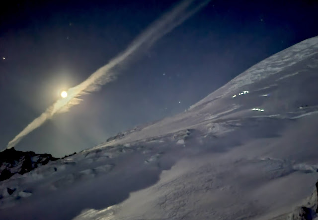
| Climbers leaving Camp Schurman under a full moon |
The rain stopped just in time for the long holiday weekend, and the skiers were ready. The Emmons/ Winthrop route saw a healthy amount of climber and skier traffic over the last several days and into mid-week. As the temperatures warmed, so did the snow from last week. Avalanche concerns have abated on the upper mountain for now but this coming weekends' low freezing levels and forecasted precipitation should make you grab your avalanche rescue gear if attempting a climb.
Here are the recent route conditions observed by rangers from White River to the summit:
White River:
Stop by the Wilderness Information Center to get your permit and a handful of blue bags before starting your climb. The rangers are friendly and knowledgeable. They want to help you be successful, while also protecting the parks fragile natural beauty.
The trail from White River campground is snow free for about one mile. The next mile has intermittent snow and melted out trail. About one mile from Glacier Basin you will find continuous snow.
Inter Glacier:
The Inter has seen more ski traffic than foot traffic recently. No crevasses are open yet, though keep your eyes open around the steeper convexities. June is typically when these cracks begin to melt out. Look for a climbers' trail near Camp Curtis (climber's left) at about 9200 feet that leads towards the Emmons Glacier. Put the rope on here and cross the Emmons glacier to Camp Schurman.
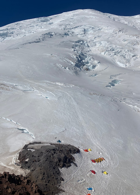 |
| Camp Schurman from Steamboat Prow |
Camp Schurman:
Avoid the helipad and find a spot to camp on the snow. Numerous tent platforms have been dug recently. A small amount of shovel work will make for a cozy place to pitch a tent. The bathroom is open and working- please keep it clean. A blue bag barrel is available right next to the bathroom for any deposits from your climb. Please pack out all your trash from your trip and leave only human waste in the bathroom.
Schurman to the Corridor:
A straightforward boot pack heads out of camp and towards the corridor. Crevasses here are not obvious, but are lurking under thin snow bridges. One party reported an individual taking a roped crevasse fall 20 feet deep into one of these hidden crevasses. They were able to self rescue with the help of another team.
The Corridor:
Excellent climbing conditions will be found here. Some crevasses are beginning to show, but they are easy to avoid. At the top of the corridor, look for a well defined boot pack leading climber's right behind some serac towers out towards the Alpine Meadow.
 |
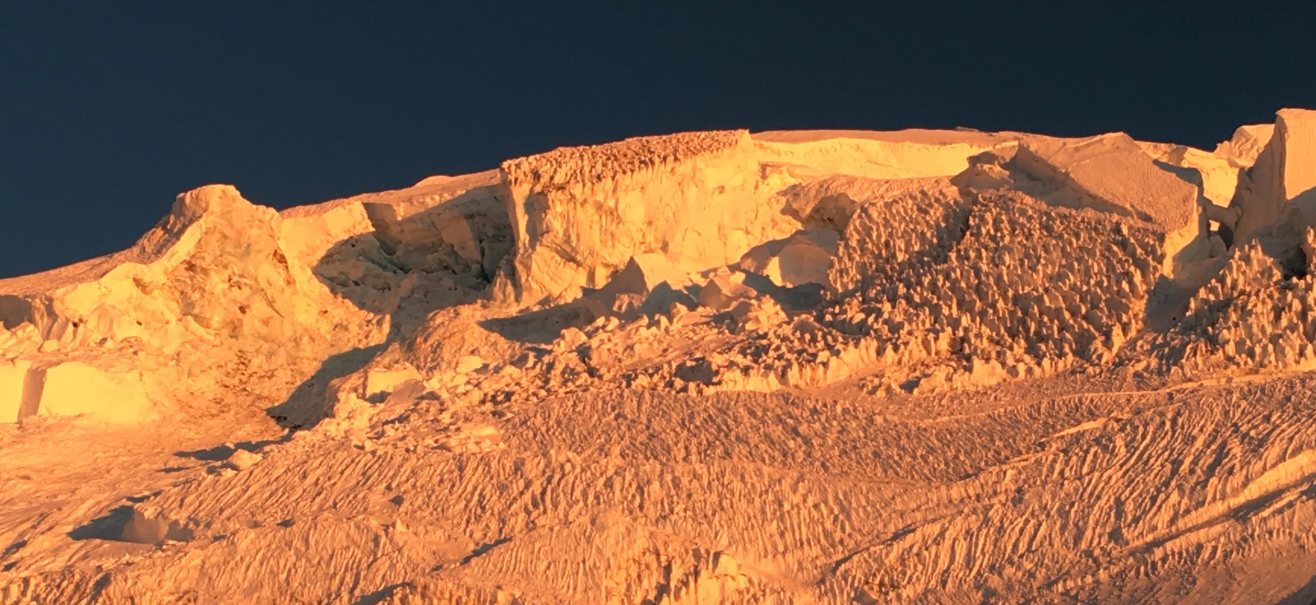
| The route above camp. |
Alpine Meadow:
Traverse right and ascend generally straight up towards a very large crevasse complex at 12,500 feet. Here, the large crevasse can be crossed on a sagging snow bridge. A belay may be a required here if the snow is soft and punchy.
Upper Mountain:
Above the 12,500 ft crevasse, follow tracks up and slightly climbers' left towards an obvious traverse out farther left at 13,500 feet. The route traverses under a large crevasse here until finally crossing a snow bridge and ascending the steep uphill wall of this crevasse. This is another wise place for a belay; especially on the descent, or if conditions are firm.
 |
| A ranger gets a belay up the crevasse crossing at 13,500 feet |
Above the 13,500 ft crack, follow the route up and climber's right towards the crater rim. This last 1,000 feet of climbing to the top is efficient and simple. Be sure to find the trail when you descend from the crater, as missing the boot pack here could easily lead you to the edge of the large bergschrung.
Descent:
Skiers had a pleasant time descending the route as the warm temperatures made conditions quite favorable for skiing last weekend. Consider a proper alpine start if you are traveling on foot to ensure the snow bridges stay firm and supportable on your descent.
Equipment:
Pickets, shovels, and crevasse rescue gear are all very necessary for the Emmons/ Winthrop route right now. Compared to previous years, the route is generally more broken up for early June than normal. Despite this, climbing conditions are quite good for those who come prepared to do some route finding.
Enjoy your climb and your time on the mountain! Please remember to drop off your check out slip at White River so rangers know you made it down safely.


