Friday, August 27, 2021

Muir Side Update

It’s feeling like Fall is approaching on Mount Rainier. The Muir Snowfield is in late season condition with lots of exposed glacial ice, rock, and even crevasses. Come prepared for a more challenging ascent to Camp Muir, with sturdy boots, crampons or spikes, and the expectation to have to navigate through some crevassed terrain. 


Camp Muir has been fairly quiet, though guide services are still taking clients up the Disappointment Cleaver route, and some independent parties are still climbing the route with some summit success.  Expect more challenging route conditions and increased rockfall hazard, particularly through the Bowling Alley and onto the Cleaver itself.

Please remember to come self-sufficient as there are fewer climbers than normal on the route. Also remember to pack out all trash from the mountain, including from Camp Muir. There are no trash receptacles at Camp Muir!  The Camp Muir public shelter remains closed, so bring a shelter if spending the night. Make sure you have proper tent anchoring systems for snow.  Tent stakes made for dirt are not appropriate for pitching a tent on Mt. Rainier!

Come up and enjoy the laid back, late season vibes on the mountain!


Kautz Ice Chute Patrol


Ranger on rappel from the Kautz Ice Chute


The Kautz ice chute is in nice form for some late season tool swinging. Rangers from the park went on a patrol on 8/23/2021, detailed below is an account of what they found along their route. 

Approach Via Comet Falls and Van Trump Park 

Comet Falls trailhead is an alternative start to climbing one of the more popular climbing routes to the top of Mt. Rainier, the Kautz Glacier. For our patrol, the Paradise approach seemed more hazardous in the late season conditions and we opted for the Van Trump Park approach option.

While longer and more elevation to surmount via this approach, there are certainly pros to the Comet Falls trail start. First, you will notice the waterfalls cascading along the trail for the first 1.6 miles to the Comet Falls viewpoint. If you have not seen Comet Falls before, you are in for a treat. Second, above the Comet Falls viewpoint your level of solitude is sure to increase. The occasional day hiker will press on from the falls to Van Trump park, but on this patrol they were few and far between. 

Rangers descending toward Van Trump Park

Snowfields and Scree 

Above Van Trump Park (5,500') the unmaintained trail ascends a defined ridge trail before giving way to the scree and talus above. The trail trends N by NE and around 7,000' you begin to move between sections of rock and snow up to approximately 7,800'. From here a consistent bit of snow travel along the upper Van Trump Glacier will put you into the 9,400' elevation zone. Trending East across the rock band below the Turtle from here allowed our team to find running water and camping options numerous enough to set up camp out of the wind.


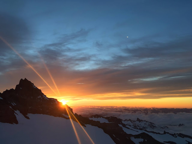
Sunset from near the Lower Castle camp around 9,400'

The Castle Area

The castle area, lower and upper, from approximately 9,250'-9,500' are common areas for teams to make camp. In the afternoon we arrived, there seemed to be an abundance of running water in this zone, and many options for camping. As the sun sets expect the water sources to reduce in flow significantly. 

The Turtle 

The two approach trails to the Kautz merge at 9,800' at the base of The Turtle. The slope of the lower turtle is approximately 45 degrees and in early season this feature can be efficiently navigated traveling on snow. We found the turtle had melted down to glacial ice, which increased the risk and slowed our travel. The icy conditions and exposure to ice and rockfall could be mitigated by staying along the western side of the terrain where the angle was slightly less steep, and the exposure to rock and ice fall was reduced. Climbing this features covers the elevation from 9,800' - 10,800' where a trail through the loose rock of the Wapowety Cleaver leads the climber to more camping options just below Camp Hazard and next to the rock step or rappel that must be descended to get into the ice chute at around 11,300'.


Looking at the upper portion from the lower section of the ice chute.

Kautz Ice Chute

To get to the ice climbing there is a rock step which must be descended. Rangers found there to be doubled, fixed static climbing ropes anchored at the step. Knots tied along the ropes would not allow the climber to rappel these ropes, but when utilized as master points to clip into with a personal anchor or a tether coming off the harness, they were helpful. At the base of the step a loose rock trail, above exposed terrain must be traversed to get onto the glacier where you traverse yet further under an area of ice fall potential with small crevasses that need to be negotiated. Moving beyond this hazard zone puts one into the ice chute and teams can pick out their line of attack from there. On 8/23 rangers found the ice pitches to be approximately two 400-450' sections, a lower and an upper section, separated by a patch of lower angle snow between the sections. The lower section was at approximately 50 degrees and the upper portion 70 degrees. Good, Fun ice climbing ensued!

For a more detailed look at the route, check out the Kautz Glacier Routebrief.


Thursday, August 19, 2021

Emmons Update

Late summer conditions and the start of fall weather patterns.

Summer heat has created challenging climbing conditions on the Emmons-Winthrop. Much of the seasonal snow has melted exposing firn ice and opening many cracks. Although challenging conditions exist, no total occlusions of the route have been reported, so summits via the Emmons may still be possible. Climbers attempting the route should come prepared to navigate complex terrain and be solidly self-sufficient, as there are no guided groups and few independent climbers on the route. Additionally, ice screws are mandatory if parties are to travel the route with sufficient security. 

Large cracks on Emmons Glacier getting to Camp Schurman

The approach to Camp Schurman has also become increasingly challenging. Getting on to the Emmons glacier from Camp Curtis still appears possible, but will require immediately crossing cracks on the glacier. Camp Schurman can also be accessed via the Steamboat Prow. The rangers at White River can describe this approach in detail. 

Lastly, our summer high pressure weather pattern is beginning to break down. This means unexpected cloud caps and widely fluctuating freezing levels. Don't get caught off guard by severe weather. Show up ready to handle fall/winter temps and surprise precipitation. 


Monday, August 16, 2021

DC Route Changes 8/16

Mountains are always changing. With all the hot and dry weather Mount Rainier has experienced in the previous months, the DC route has hit a point of a major change.

Let's get the big question out of the way: YES, you can still climb Mt Rainier via the Disappointment Cleaver route, but it's not as straightforward as it was just last week.

So what has changed?  As of 8/14 the concession guide services (RMI, AAI, IMG) have decided that they are no longer going to support the current route from Ingraham Flats to the top of the Disappointment Cleaver. It is the guide services, not the NPS, that construct and maintain the DC route including ladders, fixed protection, shoveling etc. This route work is done for their clients and the climbing public has the benefit of getting to follow along.  As a consequence, the first ladder on the route (just above Ingraham Flats) across "High Crack" has been removed.  A bypass exists above High Crack, however, that still provides access to the Cleaver.  This route is slightly steeper, icier, and moderately difficult.

   Potential route for bypassing the  "High-Crack" 

Once at the cleaver, parties will have to negotiate an area of recent rock fall and scree. This is a highly exposed zone with recurring rock fall and the reason that the guide services have elected to re-route. The risk here is significant for large groups moving slowly, but may be acceptable for smaller teams that are nimble on rock while wearing crampons. Avoid waiting for other parties in the rockfall zone, and move through as quickly as possible.  


New rockfall and the current access route onto the Disappointment Cleaver.

The route above the Cleaver  to the summit remains the same as previous posts with another ladder in-
place at 13200ft.

Today 8/16, a large group of guides are heading up to rework the route with completion TBD.  As a new route is put in place we will try to provide updates. Happy Climbing!


Friday, August 13, 2021

Four Pro Tips

Sunrise behind Little Tahoma

There are a number of common mistakes that climbing parties repeat over the years. Some of them aren't so obvious - lack of proper physical training, essential equipment and knowledge of how to use it, and of course, not checking and/or heeding the weather forecast.  There's a common thread between all of them that can be linked back to the number one principle of Leave No Trace: Proper Prior Planning.  Here's four tips to help you plan for your adventure on Mount Rainier and hopefully avoid some of these common pitfalls.

First Tip: Check the weather before you head into the field to make sure you are prepared appropriately for the conditions or if you're objectives are even feasible.  If you don't want to consider a change in your itinerary, consider changing your objectives - a stormy weekend could be perfect for practicing navigation with a new app or crevasse rescue skills, but probably not a summit attempt.  

Second Tip:  With the hottest month in human history just behind us and more high pressure on the way, heat exhaustion has been common issue this summer. Consider carrying more water than you normally would on a climb. Have a stove to melt snow on the upper mountain.  And even if you are drinking a lot of water, it might not be enough to hydrate and fuel you. Consider electrolyte drinks/tablets and make sure you snack regularly on salty food.  Mountaineering often takes more time than expected and isn't easy to train for.  Leave yourself a buffer with the amounts of both water and food you're carrying.  Take breaks.  Also - don't forget your sunscreen and sunglasses!  So important.   

Third Tip:  If you are on prescription medications, don't forget them!  Often times they aren't on the packing list and get left behind.  With certain medications and medical conditions you will want to talk to your doctor before you go on your trip. The stress, altitude, lack of sleep, and the physical exertion all can exacerbate many medical conditions.  

Fourth Tip:  Wash or sanitize your hands.  It sounds simple, but GI issues have been a common problem in the backcountry.  Bad camp hygiene and inappropriate disposal of human waste are usually the culprits for these issues. Make sure you plan to gather fresh snow for melting water, don't leave food waste (even those micro-crumbs) at your campsite, and clean up your human waste when you're not using a bathroom.  Plan to leave the mountain cleaner than you found it!

Penitentes next to the Wapowety Cleaver

There. Four Pro Tips to help you enjoy your climb on Mount Rainier.  Check and heed the weather forecast, bring plenty to hydrate with, take your prescription drugs, and wash/sanitize your hands while keeping camps and the glaciers clean.  Awesome.  See you on "the mountain" soon!

Thursday, August 12, 2021

DC Route Conditions Update

Paradise to the Muir snowfield

Leaving Paradise and heading up the Skyline Trail provides climbers the most straightforward path to the snowfield. Cross Pebble Creek at the red marked rock and avoid any off trail travel here. The meadows from Paradise to Pebble Creek are fragile. Rangers need every climber and user to stay on the trail to protect this wonderful, but fragile resource. Above Pebble Creek, the trail stays in the rocks until a well defined bootpack takes you up the steep snow rolls and onto the snowfield. 

Snowfield to Camp Muir

The lower portion of the snowfield takes a straightforward path alternating between sections of rock and snow up to approximately 8,200.' Here, consistent snow and an easy to follow bootpack leads to Camp Muir. The upper third of the Muir Snowfield has been changing quickly with this weeks hot weather. Watch out for crevasses opening up on the snowfield, especially around 9,400 feet. Cooler temperatures after this weekend might encourage parties to crampon up for sections of the snowfield above 9,000 feet.   

Smoke column from the Schneider Springs Fire seen from the Cowlitz Glacier on 8/10/2021

On your way to Camp Muir, you might notice smoke from a wildfire east of the park. The fire is called the Schneider Springs fire, and it is currently burning on National Forest land and wilderness. The fire poses no threat to the park, and more information about it can be found here: Schneider Springs Information - InciWeb the Incident Information System (nwcg.gov)


Camp Muir to Ingraham Flats

Moving across the Cowlitz follows the typical arcing path up and over Cathedral Gap. Be aware that your exposure to rockfall is high on this portion of the trail. After gaining the ridge, the trail drops towards the Ingraham and soon you will find yourself on an icy/rocky trail. If you are using a headlamp through here be on the lookout for small indications of previous travelers like crampon marks and reflective wands to stay on trail. Soon, the icy portion gives way to a solid path leading up the Ingraham, passing the flats camp area. 

Ingraham Flats to the Cleaver

After ascending the Ingraham glacier you will gain high crack, which is currently passable over a snow bridge. Just beyond high crack, a ladder crosses an open crevasse on level terrain. There is no handline on this crossing, but the level nature keeps it relatively low key. Always use your own judgement to assess any "fixed protection" along the route, and consider adding a belay of some sort to increase safety or confidence.

The ladder just beyond high crack before the traverse to Disappointment Cleaver

Climbers will lose some elevation traversing north toward the Disappointment Cleaver and the bootpack is narrow, requiring focus. As you approach the cleaver, head slightly downhill towards a pile of talus. You will cross the moat between the cleaver and the glacier by walking across boulders that have fallen into the moat. Once on the cleaver, head up a steep and loose slope with a couple of moves which require using your hands. 20' of sandy steps to put you onto the proper Cleaver trail. The lower portion of the Cleaver continues north taking the climber toward the spine. Move quickly through this section, as it is exposed to rockfall from above.

The traverse towards the cleaver is an area of increased risk emanating from objective ice and rockfall. Plan your breaks and your crossing of this zone to be as efficient and focused as possible. Consider a break after gaining the Cleaver, and remember to shorten your rope interval when traveling through the Cleaver to minimize dislodging rocks on parties below.  

Disappointment Cleaver 

The trail up the cleaver can be hard to follow at times, but keep your eyes on the lookout for reflective wands and you should be able to make steady progress. Toward the top of the DC, the trail ascends 150' of sun cupped glacier to the top of the Cleaver, which is a popular break spot. 

Ingraham Flats from Disappointment Cleaver

Upper Mountain

Guides are reporting few changes to the route above the cleaver. There is a crevasse crossing at approximately 13,200' which utilizes two ladders lashed together. The ladder is set at about a 45 degree angle, and well anchored on both sides. There are handlines to assist in this crossing. Know that the ladder has been a choke point for climbers ascending and descending the mountain. Be prepared to stagger your ascent from other parties on the upper mountain, to avoid waiting in a queue at the ladder. 

General Notes

Come prepared with a shovel so you can level out a good tent spot at Camp Muir. It is a good idea to throw a couple ice screws into your pack when preparing for your climb. The snow on the upper mountain continues to melt down to firmer, older snow, that will soon accept screws. Also, remember to secure your tent well at Camp Muir before you leave for the climb. Rangers have noticed some tents threatening to blow away while climbers are on route. You can always collapse the tent and pile a few rocks on top to make sure it doesn't take off down the Cowlitz glacier. Hot temperatures will make hydration extra difficult this weekend. Bring plenty of water and electrolytes to help stay hydrated.


Monday, August 09, 2021

Walk-Up Permits Available!

 As many of you have seen, the park has implemented a new online permit system for climbing reservations as well as ‘walk-up’ permits.  It has been functioning well by enabling a streamlined reservation process.  However, we have identified a glitch in the new system that causes the number of available sites at Camp Muir and Camp Schurman to be less than what is available.  We have alerted the developers and they are working a fix.  In the meantime, the developers have posted an alert on the page describing the glitch.

Here is the issue.  Despite what the site may seem to indicate, every night-before and throughout the next day, there is room for thirty climbers at Camp Muir and twelve climbers at Camp Schurman just via “walk-up” (day-of) permits for that day.  Here’s an example from a screenshot of recreation.gov:


Note that the green-circled “W” indicates that there are still walk-up permits available.  Show up to the ranger station in-person up to a day before your intended start and you can be issued a permit.  

The yellow-circled “3” indicates there are only three “reservable” sites left to get a permit in advance – but that walk-up (30 Muir/12 Schurman) permits are still available.

The red-circled “0” indicates that there are no reservable permits available but doesn’t reflect the amount of walk-up permits still free (30 Muir/12 Schurman).  

Unfortunately, there’s no great way of showing the current availability of walk-up permits, so it’s a bit of a gamble to show up and expect to secure one – but the odds are in your favor!  On one of our busiest weekends (Fourth of July) there was still plenty of walk-up space available.  While we can’t guarantee that a walk-up permit will be available, it’d be a surprise if we couldn’t work it out – especially for smaller teams with flexible itineraries. 

The site administrators have been made aware of this issue and the confusion it’s causing and are working to rectify it.  Currently, they’ve put an alert on the site to let climbers know about the issue:


In the meantime, don’t let the site’s numbers discourage you from attempting to get a walk-up permit!  

Here is the link to the Mount Rainier National Park Wilderness and Climbing Permits system:

https://www.recreation.gov/permits/4675317

Sunday, August 08, 2021

Emmons Update 8/8

 As the summer presses on climbers continue to summit via the Emmons Winthrop route.

The Inter Glacier is down to mostly skeletal ice and crevasses are obvious and numerous. Use crampons, ice axe, and ice screws if you choose to go this way. Another option is Mt. Ruth, there is a good climbers trail that gains the southern ridge line from Glacier basin. The climbers trail follows the ridge all the way to Steamboat Prow. Finding the trail from glacier basin is not obvious, so talk with rangers at White River to get more information before planning to use this trail. There is a mandatory water crossing at glacier basin so extra socks and shoes are a good idea when using Mt. Ruth. 

The glaciers have dropped away from both sides of Camp Schurman reducing access options from the Emmons. There is a moat crossing getting onto the Emmons from Camp Curtis. Some climbing parties are opting to use Steamboat Prow for access to camp. Climbers will encounter loose rock and steep exposed terrain with either option.


From Camp Schurman to Emmons Flats climbers will encounter mostly broken glacial ice.  Crossing the flats up to the corridor is still snow covered and fairly direct. Climbers can still find decent camping options at the flats. The corridor up to 11,000' is a mix of snow and ice with crevasses still hidden under thin bridges of snow. 

From the top of the corridor the route goes left around a large ice serac before traversing back climbers right to gain the alpine meadow around 12,000'. The route continues to traverse back climbers right out to the Winthrop shoulder. From the shoulder, climbers will end run crevasses up to 13,200'. At this point climbers can go left or right. Going left will lead climbers on broad open terrain that will eventually connect to the DC route. Going right, climbers will encounter steep broken snow bridges before reaching the bergschrund around 13,800. Traversing the bergschrund to the climbers right will lead to lower angle terrain leading to the crater rim.


Climbing the Emmons is a real mountaineering adventure and will require route finding and self reliance. Another round of high pressure and 15,000' freezing levels are forecasted for the coming week. Conditions are everchanging and finding your way down off the mountain may be different from the way you came up. Be prepared for the unexpected and plenty of wilderness solitude.