Showing posts with label Mowich Face. Show all posts

Thursday, May 21, 2026

Aerial Route Photos from Thursday, May 21st

Upper Ingraham Glacier

Fuhrer Finger

Upper Kautz Glacier

Success Couloir 

Tahoma Glacier

Mowich Face

Upper Ptarmigan Ridge

Upper Liberty Ridge 


Thursday, May 30, 2024

Upper Mountain Conditions Photos from 5/23

Success Couloirs (Center)


Kautz Ice cliff (Center Right)

Russell Cliffs and Curtis Ridge (Willis Wall in the background)


Willis Wall and Liberty Ridge


Ptarmigan Ridge (Center)

Sunday, May 15, 2022

April Showers.. and May Storms!

It's been an unprecedented stormy start to the summer on Mount Rainier.  Prepare for full winter conditions for any adventure in the park this May.  Not much to report conditions-wise since weather has been shutting most of the climbing and skiing down.  Use caution when entering onto steeper slopes on the upper mountain - the snow pack hasn't transitioned to a regular spring diurnal pattern yet, and there could be hazardous conditions with all of the new snow.  

The Paradise Wilderness Information Center (PWIC) is already open on weekends - come on up and register in-person!  Self-registration is still in effect during the weekdays until May 27th.  After May 27th the PWIC will be open everyday through the end of the climbing season in September.  Paying the Climbing Fee and obtaining a Climbing Permit is required for all climbers and skiers who journey above 10,000 feet or onto a glacier - even folks doing a single-push style ascent.

Rangers were able to get up in the helicopter for some aviation training and snapped some photos of the upper mountain.  See below for some photos taken May 10th and 11th.  We're excited for more stable weather patterns and a bit more sunshine - and excited to see everyone up on the mountain soon! 


Sunday, June 16, 2019

West - North Side Conditions Photos - 6/16/2019

Left to right: Sunset Ridge, Sunset Amphitheater, Puyallup Cleaver, Tahoma Glacier, Tahoma Cleaver.

On Sunday our helicopter crew took some aerial photos of the west and northwest side of the mountain on their flight up to North Cascades National Park. The hot weather appears to have taken its toll on Liberty Ridge.  Reports from several parties that approached Liberty Ridge over the weekend stated that the lower ridge is mostly rock and that there is near constant rockfall on the route.  Conditions turned most of these parties away.

Left to right: Ptarmigan Ridge, Mowich Face, Sunset Ridge.   
Left to right: Ptarmigan Ridge, North Mowich Headwall, Central Mowich Face, Edmunds Headwall, Sunset Ridge.


Left to right: Ptarmigan Ridge, North Mowich Icefall, North Mowich Headwall, Central Mowich Face, Edmunds Headwall, Sunset Ridge.

Ptarmigan Ridge in the center.  Mowich Face on the right.

Left to right: Curtis Ridge, Willis Wall, Liberty Ridge, Ptarmigan Ridge, Mowich Face.


Friday, May 10, 2019

North and West Side Conditions Update 5/10/2019


Carbon glacier and Liberty Ridge
      This past week of excellent weather allowed a pair of climbing rangers to circumnavigate the mountain and get eyes on many of the climbing routes. As a general trend, many of the routes on the mountain are holding less snow than average for this time of year but are still in good shape. This post will focus mostly on the routes on the North and West sides, for specifics on the Kautz, DC, or Emmons-Winthrop, see those specific blog posts.

Curtis Ridge: The lower half of the route to the Gendarme is snow covered. The upper cliff bands appear to be quite dry and ice runnels were not plainly visible.
Curtis Ridge and the Carbon Glacier, viewed from the Russell Glacier
Liberty Ridge and the Carbon Glacier: The lower Carbon is relatively filled in, allowing what appear to be at least 2 viable approaches to Liberty Ridge
The Carbon Glacier and North side of the mountain
 Mowich Face Routes: All routes appear to have possible bergschrund crossings, the Edmunds Headwall presents the most complicated looking bergschrund crossing. No ice fall debris was evident, but the cliffs still loom quite large.
The Mowich Face and Edmunds Headwall
Sunset Ridge: The approach via the Puyallup and South Mowich Glaciers are filled-in and present few navigational challenges. The ridge itself appears snowy all the way to the top.
Lower Sunset Ridge from the South Mowich Glacier
Tahoma Glacier: This route appears to be quite broken above about 9500 feet. The lower Tahoma Glacier from Glacier Island up to 9500’ offers reasonable passage to the Tahoma Cleaver. The Sickle has recent-looking debris from serac fall.
The upper Puyallup Glacier
Success Cleaver: Largely snow covered with bits of rock poking out.
Success Couloir: Bergschrund still appears to be passable. Headwall melting out with lots of exposed rocks
A Climbing Ranger ascending early in the morning. Success Couloirs in the background.
With the unseasonable warm temperatures forecasted for the coming weekend, be prepared for changing conditions on many of these routes. Be cognizant of your travel timing, and be aware of the possibility of wet loose and wet slab avalanches on all aspects. As always, check the weather forecast before departing and be prepared.

Friday, May 25, 2018

Sunset Ridge Conditions

Looking up the South Mowich Glacier towards St. Andrews Rock. 
Sunset Ridge is the rimed skyline in the middle of the photo.
Sunset Ridge is currently in good condition.  Overall, the Puyallup & South Mowich Glaciers were navigable and the bergshrund crossings were passable without too much effort to find a suitable bridge, although with the warm weather in the forecast, the lower 'shrund may collapse soon and impede travel to the upper ridge.

Crossing the South Mowich Glacier is straightforward and no major crevasse crossings were required (Photo 1).  From there, we encountered mellow climbing around the bottom buttress of Sunset Ridge up to the bergschrund (Photo 2). We found firm conditions up the 1800' lower "pyramid-face" before gaining the Sunset Ridge proper at 11650'  There is a short section of easier, but technical climbing on the ridge before bumping out climber's left onto the upper Mowich Face (Photo 6).  Once on the face, we found firm 55-60 degree snow with glacier ice a few inches below the surface that accepted ice screws.  This sectioned involved roughly 1300' of front-pointing (Photo 8)  From the top of the face, easy navigation led up to Liberty Cap, and from there, across the saddle to Columbia Crest.

This route involves a fair amount of elevation gain and mileage from the base of the route.  The route itself clocks in around 6400' of gain over 5 miles plus the approach and descent.  It's a big push, but well worth the effort for the views of the western side of the mountain.  That said, the location of Sunset Ridge is one of the more remote locations inside Mount Rainier National Park, so it see's very little traffic.  Expect conditions to be different from this description and come prepared for technical climbing, long days, rock and icefall and the possibility of impassable crevasses or bergshrunds.

The following photos are listed in order starting from the lowest elevation.


Looking up the lower portion of the "Pyramid" on the lower portion of the Sunset Ridge route.  The bergshrund was crossable far climber's right, below the saddle.

Looking downhill from the top of the "lower pyramid" around ~11,500'

Looking down Sunset Ridge. Puyallup Glacier is the large glacier seen below.

Navigating steep snow and rock along Sunset Ridge.

Looking towards the upper Mowich Face.  Minimal snow on the ridge forces the route
onto the face, opposed to following the ridge all the way up to Liberty Cap


Looking down the Upper Mowich Face toward Sunset Ridge
Steep 55-60 degree snow on the upper Mowich Face

Overview of route taken from camp at 8500' on the S. Mowich Glacier to Columbia Crest

Thursday, May 24, 2018

General Mountain Update

With the busy Memorial Day Weekend approaching, here is a general update of conditions for parts of the mountain.  Climbing rangers are finished with their extensive early season training and will be staffing both Camp Muir and Camp Schurman through this weekend and for most of the remainder of the summer.  If your party is overnighting at either of these high camps expect a briefing from a climbing ranger sometime in the early evening and have your permit information handy.  With the amount of climbers anticipated to be on the mountain this weekend, especially at Camp Muir, count on a busy camp and climbing route and plan accordingly.  Please be patient and courteous with other climbers and NPS employees and hopefully we can all experience a safe and enjoyable weekend on the mountain.

5/23/2018

That being said, here are some details on route conditions.  On Tuesday, 5/22, a team of climbing rangers ascended Sunset Ridge and carried over the summit and down the Ingraham Direct route to Camp Muir.  Rangers found excellent climbing conditions along the way (a detailed blog post on Sunset Ridge coming soon).   Conditions on the upper Mowich Face included 4-6 inches of snow over hard ice.  This allowed for efficient climbing and the option of placing running protection using both pickets and ice screws.  As for skiing on the upper Mowich and Edmunds: this probably isn't the season to do so.  In addition to the blue ice underlying the thin snow-cover, the bergschrund appears to run the full width of the lower Edmunds Headwall and most of the way across the lower Central Mowich Face.  

A view of the Edmunds Headwall from the air - 5/21/2018. 

The main route from Camp Muir is still ascending the Ingraham Direct (ID) route, which is mostly unchanged from the last post, although things are starting to melt out more rapidly with the higher temperatures.  The ID currently has a well-defined boot path and is marked by wands.  Keep in mind that during this time of year the routes see rapid change.  It is certainly possible that in the time of your climb snow bridges could collapse and leave you searching for an alternate route on your descent.  This occurred on Tuesday as a large party of skiers attempting to ski the Fuhrer Finger route were turned around by a collapse of a bridge somewhere near the upper Nisqually Glacier.  They were forced to climb back up and descend the ID instead.  So, at this point, it appears the Fuhrer Finger route may be unskiable from the summit and difficult or impossible to navigate on foot as well.  Your mileage may vary, but these were the reports that rangers received on Tuesday.  First-hand beta from the Kautz Glacier is limited, but upon observation from lower on the mountain it appears that the lower ice pitch on the Kautz is exposed ice while the upper ice pitch is still snow covered.

Upper Nisqually Glacier - 5/23/2018.

The Muir Snowfield, however, is looking very skiable.  Rangers descending on foot on Wednesday, 5/23, were wishing they had skis as they were plunge stepping through smooth corn snow from Muir to about 8,000ft.  This was at approximately 1:00 p.m.  Below 8,000 there hasn't been a consistent overnight freeze so the snow is still a little gloppy.  Most people are now using the approximate summer route to get to the snowfield.  Panorama Point is quickly melting out.  Remember, as the snow melts and exposes ground, it is important to stay on the trail or snow to avoid trampling over the sensitive alpine vegetation.  Also, please remember to watch out for dangerous and thinning snow bridges and holes over creeks and moats throughout the park, especially at and above treeline.  These can be very hazardous and have contributed to fatalities and close-calls in the past. Slow, controlled descents and having a clear visual of the slope help reduce the likelihood of these hazards.
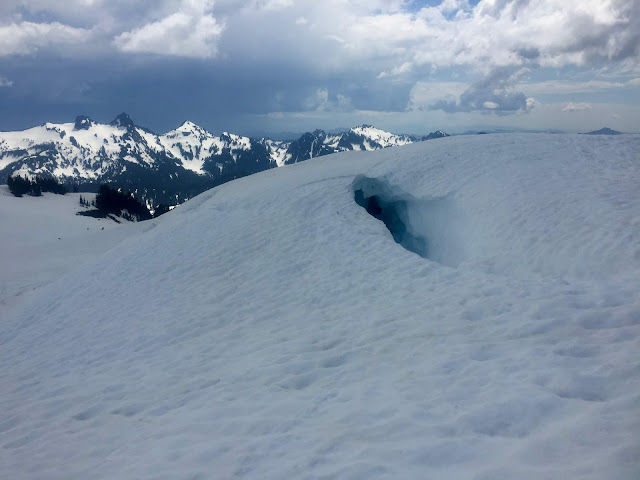
Hazardous snow around Glacier Vista.  

The upper mountain has been seeing a significant amount of skier traffic recently.  While this can be a very rewarding method of travel on Mt. Rainier, it does come with an increased risk.  Lately, rangers have observed some disturbing tactics involving skiers, including parties unroping and separating while some members ski and some walk down with skis on their back, opening them up to an unroped crevasse fall that might not be witnessed by the rest of their party members.  Keep these points in mind if you will be attempting to ski on the upper mountain:  (1) You MUST be a strong skier in all conditions and you MUST NOT fall.  (2) Who is going to carry the rope and how many ropes will you bring?  Will each member of the party carry a rope on the descent, or just the rear skier?  How long is your rope?  Will it reach the bottom of a crevasse if your buddy falls in while skiing?  (3) If one of your party members decides that skiing is above their ability level, it is a good idea that the whole team join them in putting the rope back on and walking down together.  (4) You CAN walk back down, roped-up, if conditions are not favorable to skiing.  That is the safer option.

Lastly, the Paradise Wilderness Information Center (formerly the Climbing Information Center) is now open daily for the summer.  You must register for your climb in person - there is no more self-registration for the season.  The PWIC is open from 7:00 a.m. to 4:00 p.m. Enjoy the sunshine and be safe out there!


Tuesday, April 24, 2018

Early Season Photographs!


Liberty Ridge, April 2018
Here are some images of the upper mountain taken April 19th, 2018. Remember that conditions can change rapidly and the snow coverage in these photos is likely different than it was just a few days ago.

Notable observations included visibly icy conditions on the upper reaches of Liberty Ridge, bare ice on the Kautz Glacier route, and several large avalanche crowns on a variety of aspects and elevations.

More photos can be viewed here.

Fuhrer Finger
Ingraham Glacier and Disappointment Cleaver