Sunday, October 31, 2021

Fall Skiing Considerations


Backcountry skiers and snowboarders near Panorama Pt. -NPS Photo

A series of storms has deposited new snow on the mountain over the last few weeks. Skiers and snowboarders have taken advantage of clear weather between systems to start their winter season. On Saturday, Oct 30 the upper lot at Paradise was full by 10:30am, mostly with snow-sliders. Conditions this time of year are always a mixed-bag and coverage is usually spotty at best.

The Paradise area trails are still exposed in most places with very slippery patches of ice in places. Skiers/boarders carried their equipment on their packs up to the top of Panorama Point for the most part. Above there the Muir snowfield was mostly covered in rime ice with a few patches of soft snow near 9000'. Many people turned around at 9000' or below where the rime was very slick. A few (mostly the ones that brought ski-crampons) made it to Camp Muir where the weather was calm and quite warm compared to Paradise.

Please remember that at this time of year the days are short and the gate at Longmire is on winter hours. Plan your turn around time to make to back to your vehicle with enough time to be down by the time the road closes to traffic. Please look here for all of the Park's road status.

Remember that emergency response is more difficult when the trails are snow covered. Ski, ride, hike well within your abilities as the winter environment on Mt. Rainier is extremely harsh.

Another issue this time of year is the trampling of vegetation. A thin layer of snow may allow one to slide on skis or snowboard but it may not be sufficient to protect the wildflower species that Paradise is famous for. The Dead Horse Creek junction was hit especially hard over the weekend. Have fun and enjoy your park but please give the plants a break while they go dormant until next July.


Skier and hiker tracks near Dead Horse Creek. -NPS Photo

Wednesday, September 22, 2021

Autumn/Winter 2021

Summer is officially over and the climbing season is pretty much wrapped up here on Mt Rainier. The end of the season was a unique one for sure with most routes becoming significantly impacted by significant heat waves this summer. This resulted in more crevassing on the glaciers and increased rockfall on the ridges.

Snowfall has returned however, and while this is a good thing for the mountain in general it does make an autumn or early winter ascent particularly dangerous. Crevasses are just barely covered with a thin blanket of snow. And so, be prepared to rope-up: have helmets, harnesses, ice axes, crampons, pickets and other glacier travel equipment with you, potentially just to travel to Camp Muir! 

The Cowlitz Glacier and Cathedral Rocks

In the regular season, a trip to Camp Muir can be done without that extra equipment, but this year's late-season conditions are extreme and especially dangerous with icy, crevassed surface conditions being hidden by fresh snow. Any climber attempting the summit this time of year should consider it an off-season climb and be very experienced, totally self-sufficient, and realize that any emergency help could be not just hours, but days away.  

Late season storms can roll in with little warning and can be much more vigorous and longer lasting than summer squalls. Please check the weather forecast before starting your trip - click on the Weather Resources tab above for some starting places - but keep in mind that forecasting for Mt Rainier is very difficult, so prepare for the unexpected! Stretches of beautiful summer-like weather can also be possible, and late-season visits do offer more solitude than the more popular times, but please be cautious this time of year.

All climbers are still required to pay the annual climbing fee (which can be done online ahead of time) and obtain a climbing permit (which has switched to self-registration for the winter season and can be done in-person at the trailhead).  Enjoy the change of seasons and climb safe!

Saturday, September 11, 2021

Late Summer on Mount Rainier

Looking down onto the Muir Snowfield - icy, crevassed, and rocky late-season conditions!

Its begun to feel like fall up on the mountain.  Over the past week, vine maples have started turning orange and red, huckleberries have ripened and guide services have wrapped up their daily summit climbs. The season wrap-up at Camp Muir and the Disappointment Cleaver has begun.  Route adjuncts like ladders and hand-lines have been pulled off the route.  Tents and equipment caches at Ingraham Flats have been removed.  

If you choose to hike to Camp Muir this fall, expect to encounter icy conditions, crevasses, moulins and the lack of an established boot-pack.  Some sort of traction like crampons, shoe chains or spikes and an ice axe is recommended right now.  Consider full glacier-climbing kits just to get to Camp Muir!  In addition to difficult travel conditions, weather conditions also tend to become more unpredictable and expectations of cooler and wetter weather should begin to become more of a consideration when planning a trip.  

Until further notice, the Camp Muir Public Shelter will remain Closed, (Emergency Use Only), due to COVID-19.

Here's a run down of the common climbing routes currently:

Disappointment Cleaver - As of today, September 11th, all ladders, fixed lines and fixed pickets have been removed for the season.  Past this date, it will be extremely difficult to climb past Camp Muir and a high degree of skill and planning will be required in order to safely and effectively navigate upper mountain terrain.  Don’t expect there to be any other parties on the route - you’ll have to be self-sufficient and have a contingency plan in place for yourselves.  

Emmons/Winthrop - This route has not seen an attempt in the last three to four weeks.  A large portion of the route consists of ablated glacier ice, high consequence crevasse crossings and complex route finding.  This route should be considered "out for the season" as a standard route.  The Inter Glacier is also experiencing late season conditions.  Crevasses, glacier ice and rockfall are all present and add significant hazard right now.

Kautz Glacier - Not many parties have climbed the route in the last couple weeks, but the most recent blog post from August 23rd is still, for the most part accurate.  The ice pitches will continue to grow in length and crevasses above the Wapowety Cleaver will continue to be more complicated to cross.  The approach up Comet Falls Trail to this route is the preferred method - crossing over the lower Nisqually Glacier has become very difficult.  A descent of the DC will be extremely difficult due to the lack of ladders and additional route adjuncts.

____________________________________________________

All this being said, the mountain is by no means "Closed".  We welcome you to come and enjoy the autumn experience Mount Rainier has to offer.  It really is a great time of year to take in the sights and sounds of the changing seasons.  And also a wonderful opportunity to find moments of solitude up high before winter hits!

As we move into late-season here on the mountain, registration changes will occur; check the park's permit website for the latest, but here's the gist:

The Paradise Wilderness Information Center (PWIC) will be open 7 days a week from 7:30am to 5:00pm until Sunday September 26th. All climbing permits starting Monday 9/27/21 will be by self-registration.  Until that date, all climbers and campers who wish to spend the night will need a permit to do so and ALL climbers must still pay the annual climbing fee.


A hiker takes a moment to assess crevasses on the Muir Snowfield.


Friday, August 27, 2021

Muir Side Update

It’s feeling like Fall is approaching on Mount Rainier. The Muir Snowfield is in late season condition with lots of exposed glacial ice, rock, and even crevasses. Come prepared for a more challenging ascent to Camp Muir, with sturdy boots, crampons or spikes, and the expectation to have to navigate through some crevassed terrain. 


Camp Muir has been fairly quiet, though guide services are still taking clients up the Disappointment Cleaver route, and some independent parties are still climbing the route with some summit success.  Expect more challenging route conditions and increased rockfall hazard, particularly through the Bowling Alley and onto the Cleaver itself.

Please remember to come self-sufficient as there are fewer climbers than normal on the route. Also remember to pack out all trash from the mountain, including from Camp Muir. There are no trash receptacles at Camp Muir!  The Camp Muir public shelter remains closed, so bring a shelter if spending the night. Make sure you have proper tent anchoring systems for snow.  Tent stakes made for dirt are not appropriate for pitching a tent on Mt. Rainier!

Come up and enjoy the laid back, late season vibes on the mountain!


Kautz Ice Chute Patrol


Ranger on rappel from the Kautz Ice Chute


The Kautz ice chute is in nice form for some late season tool swinging. Rangers from the park went on a patrol on 8/23/2021, detailed below is an account of what they found along their route. 

Approach Via Comet Falls and Van Trump Park 

Comet Falls trailhead is an alternative start to climbing one of the more popular climbing routes to the top of Mt. Rainier, the Kautz Glacier. For our patrol, the Paradise approach seemed more hazardous in the late season conditions and we opted for the Van Trump Park approach option.

While longer and more elevation to surmount via this approach, there are certainly pros to the Comet Falls trail start. First, you will notice the waterfalls cascading along the trail for the first 1.6 miles to the Comet Falls viewpoint. If you have not seen Comet Falls before, you are in for a treat. Second, above the Comet Falls viewpoint your level of solitude is sure to increase. The occasional day hiker will press on from the falls to Van Trump park, but on this patrol they were few and far between. 

Rangers descending toward Van Trump Park

Snowfields and Scree 

Above Van Trump Park (5,500') the unmaintained trail ascends a defined ridge trail before giving way to the scree and talus above. The trail trends N by NE and around 7,000' you begin to move between sections of rock and snow up to approximately 7,800'. From here a consistent bit of snow travel along the upper Van Trump Glacier will put you into the 9,400' elevation zone. Trending East across the rock band below the Turtle from here allowed our team to find running water and camping options numerous enough to set up camp out of the wind.


Sunset from near the Lower Castle camp around 9,400'

The Castle Area

The castle area, lower and upper, from approximately 9,250'-9,500' are common areas for teams to make camp. In the afternoon we arrived, there seemed to be an abundance of running water in this zone, and many options for camping. As the sun sets expect the water sources to reduce in flow significantly. 

The Turtle 

The two approach trails to the Kautz merge at 9,800' at the base of The Turtle. The slope of the lower turtle is approximately 45 degrees and in early season this feature can be efficiently navigated traveling on snow. We found the turtle had melted down to glacial ice, which increased the risk and slowed our travel. The icy conditions and exposure to ice and rockfall could be mitigated by staying along the western side of the terrain where the angle was slightly less steep, and the exposure to rock and ice fall was reduced. Climbing this features covers the elevation from 9,800' - 10,800' where a trail through the loose rock of the Wapowety Cleaver leads the climber to more camping options just below Camp Hazard and next to the rock step or rappel that must be descended to get into the ice chute at around 11,300'.


Looking at the upper portion from the lower section of the ice chute.

Kautz Ice Chute

To get to the ice climbing there is a rock step which must be descended. Rangers found there to be doubled, fixed static climbing ropes anchored at the step. Knots tied along the ropes would not allow the climber to rappel these ropes, but when utilized as master points to clip into with a personal anchor or a tether coming off the harness, they were helpful. At the base of the step a loose rock trail, above exposed terrain must be traversed to get onto the glacier where you traverse yet further under an area of ice fall potential with small crevasses that need to be negotiated. Moving beyond this hazard zone puts one into the ice chute and teams can pick out their line of attack from there. On 8/23 rangers found the ice pitches to be approximately two 400-450' sections, a lower and an upper section, separated by a patch of lower angle snow between the sections. The lower section was at approximately 50 degrees and the upper portion 70 degrees. Good, Fun ice climbing ensued!

For a more detailed look at the route, check out the Kautz Glacier Routebrief.


Thursday, August 19, 2021

Emmons Update

Late summer conditions and the start of fall weather patterns.

Summer heat has created challenging climbing conditions on the Emmons-Winthrop. Much of the seasonal snow has melted exposing firn ice and opening many cracks. Although challenging conditions exist, no total occlusions of the route have been reported, so summits via the Emmons may still be possible. Climbers attempting the route should come prepared to navigate complex terrain and be solidly self-sufficient, as there are no guided groups and few independent climbers on the route. Additionally, ice screws are mandatory if parties are to travel the route with sufficient security. 

Large cracks on Emmons Glacier getting to Camp Schurman

The approach to Camp Schurman has also become increasingly challenging. Getting on to the Emmons glacier from Camp Curtis still appears possible, but will require immediately crossing cracks on the glacier. Camp Schurman can also be accessed via the Steamboat Prow. The rangers at White River can describe this approach in detail. 

Lastly, our summer high pressure weather pattern is beginning to break down. This means unexpected cloud caps and widely fluctuating freezing levels. Don't get caught off guard by severe weather. Show up ready to handle fall/winter temps and surprise precipitation. 


Monday, August 16, 2021

DC Route Changes 8/16

Mountains are always changing. With all the hot and dry weather Mount Rainier has experienced in the previous months, the DC route has hit a point of a major change.

Let's get the big question out of the way: YES, you can still climb Mt Rainier via the Disappointment Cleaver route, but it's not as straightforward as it was just last week.

So what has changed?  As of 8/14 the concession guide services (RMI, AAI, IMG) have decided that they are no longer going to support the current route from Ingraham Flats to the top of the Disappointment Cleaver. It is the guide services, not the NPS, that construct and maintain the DC route including ladders, fixed protection, shoveling etc. This route work is done for their clients and the climbing public has the benefit of getting to follow along.  As a consequence, the first ladder on the route (just above Ingraham Flats) across "High Crack" has been removed.  A bypass exists above High Crack, however, that still provides access to the Cleaver.  This route is slightly steeper, icier, and moderately difficult.

   Potential route for bypassing the  "High-Crack" 

Once at the cleaver, parties will have to negotiate an area of recent rock fall and scree. This is a highly exposed zone with recurring rock fall and the reason that the guide services have elected to re-route. The risk here is significant for large groups moving slowly, but may be acceptable for smaller teams that are nimble on rock while wearing crampons. Avoid waiting for other parties in the rockfall zone, and move through as quickly as possible.  


New rockfall and the current access route onto the Disappointment Cleaver.

The route above the Cleaver  to the summit remains the same as previous posts with another ladder in-
place at 13200ft.

Today 8/16, a large group of guides are heading up to rework the route with completion TBD.  As a new route is put in place we will try to provide updates. Happy Climbing!


Friday, August 13, 2021

Four Pro Tips

Sunrise behind Little Tahoma

There are a number of common mistakes that climbing parties repeat over the years. Some of them aren't so obvious - lack of proper physical training, essential equipment and knowledge of how to use it, and of course, not checking and/or heeding the weather forecast.  There's a common thread between all of them that can be linked back to the number one principle of Leave No Trace: Proper Prior Planning.  Here's four tips to help you plan for your adventure on Mount Rainier and hopefully avoid some of these common pitfalls.

First Tip: Check the weather before you head into the field to make sure you are prepared appropriately for the conditions or if you're objectives are even feasible.  If you don't want to consider a change in your itinerary, consider changing your objectives - a stormy weekend could be perfect for practicing navigation with a new app or crevasse rescue skills, but probably not a summit attempt.  

Second Tip:  With the hottest month in human history just behind us and more high pressure on the way, heat exhaustion has been common issue this summer. Consider carrying more water than you normally would on a climb. Have a stove to melt snow on the upper mountain.  And even if you are drinking a lot of water, it might not be enough to hydrate and fuel you. Consider electrolyte drinks/tablets and make sure you snack regularly on salty food.  Mountaineering often takes more time than expected and isn't easy to train for.  Leave yourself a buffer with the amounts of both water and food you're carrying.  Take breaks.  Also - don't forget your sunscreen and sunglasses!  So important.   

Third Tip:  If you are on prescription medications, don't forget them!  Often times they aren't on the packing list and get left behind.  With certain medications and medical conditions you will want to talk to your doctor before you go on your trip. The stress, altitude, lack of sleep, and the physical exertion all can exacerbate many medical conditions.  

Fourth Tip:  Wash or sanitize your hands.  It sounds simple, but GI issues have been a common problem in the backcountry.  Bad camp hygiene and inappropriate disposal of human waste are usually the culprits for these issues. Make sure you plan to gather fresh snow for melting water, don't leave food waste (even those micro-crumbs) at your campsite, and clean up your human waste when you're not using a bathroom.  Plan to leave the mountain cleaner than you found it!

Penitentes next to the Wapowety Cleaver

There. Four Pro Tips to help you enjoy your climb on Mount Rainier.  Check and heed the weather forecast, bring plenty to hydrate with, take your prescription drugs, and wash/sanitize your hands while keeping camps and the glaciers clean.  Awesome.  See you on "the mountain" soon!

Thursday, August 12, 2021

DC Route Conditions Update

Paradise to the Muir snowfield

Leaving Paradise and heading up the Skyline Trail provides climbers the most straightforward path to the snowfield. Cross Pebble Creek at the red marked rock and avoid any off trail travel here. The meadows from Paradise to Pebble Creek are fragile. Rangers need every climber and user to stay on the trail to protect this wonderful, but fragile resource. Above Pebble Creek, the trail stays in the rocks until a well defined bootpack takes you up the steep snow rolls and onto the snowfield. 

Snowfield to Camp Muir

The lower portion of the snowfield takes a straightforward path alternating between sections of rock and snow up to approximately 8,200.' Here, consistent snow and an easy to follow bootpack leads to Camp Muir. The upper third of the Muir Snowfield has been changing quickly with this weeks hot weather. Watch out for crevasses opening up on the snowfield, especially around 9,400 feet. Cooler temperatures after this weekend might encourage parties to crampon up for sections of the snowfield above 9,000 feet.   

Smoke column from the Schneider Springs Fire seen from the Cowlitz Glacier on 8/10/2021

On your way to Camp Muir, you might notice smoke from a wildfire east of the park. The fire is called the Schneider Springs fire, and it is currently burning on National Forest land and wilderness. The fire poses no threat to the park, and more information about it can be found here: Schneider Springs Information - InciWeb the Incident Information System (nwcg.gov)


Camp Muir to Ingraham Flats

Moving across the Cowlitz follows the typical arcing path up and over Cathedral Gap. Be aware that your exposure to rockfall is high on this portion of the trail. After gaining the ridge, the trail drops towards the Ingraham and soon you will find yourself on an icy/rocky trail. If you are using a headlamp through here be on the lookout for small indications of previous travelers like crampon marks and reflective wands to stay on trail. Soon, the icy portion gives way to a solid path leading up the Ingraham, passing the flats camp area. 

Ingraham Flats to the Cleaver

After ascending the Ingraham glacier you will gain high crack, which is currently passable over a snow bridge. Just beyond high crack, a ladder crosses an open crevasse on level terrain. There is no handline on this crossing, but the level nature keeps it relatively low key. Always use your own judgement to assess any "fixed protection" along the route, and consider adding a belay of some sort to increase safety or confidence.

The ladder just beyond high crack before the traverse to Disappointment Cleaver

Climbers will lose some elevation traversing north toward the Disappointment Cleaver and the bootpack is narrow, requiring focus. As you approach the cleaver, head slightly downhill towards a pile of talus. You will cross the moat between the cleaver and the glacier by walking across boulders that have fallen into the moat. Once on the cleaver, head up a steep and loose slope with a couple of moves which require using your hands. 20' of sandy steps to put you onto the proper Cleaver trail. The lower portion of the Cleaver continues north taking the climber toward the spine. Move quickly through this section, as it is exposed to rockfall from above.

The traverse towards the cleaver is an area of increased risk emanating from objective ice and rockfall. Plan your breaks and your crossing of this zone to be as efficient and focused as possible. Consider a break after gaining the Cleaver, and remember to shorten your rope interval when traveling through the Cleaver to minimize dislodging rocks on parties below.  

Disappointment Cleaver 

The trail up the cleaver can be hard to follow at times, but keep your eyes on the lookout for reflective wands and you should be able to make steady progress. Toward the top of the DC, the trail ascends 150' of sun cupped glacier to the top of the Cleaver, which is a popular break spot. 

Ingraham Flats from Disappointment Cleaver

Upper Mountain

Guides are reporting few changes to the route above the cleaver. There is a crevasse crossing at approximately 13,200' which utilizes two ladders lashed together. The ladder is set at about a 45 degree angle, and well anchored on both sides. There are handlines to assist in this crossing. Know that the ladder has been a choke point for climbers ascending and descending the mountain. Be prepared to stagger your ascent from other parties on the upper mountain, to avoid waiting in a queue at the ladder. 

General Notes

Come prepared with a shovel so you can level out a good tent spot at Camp Muir. It is a good idea to throw a couple ice screws into your pack when preparing for your climb. The snow on the upper mountain continues to melt down to firmer, older snow, that will soon accept screws. Also, remember to secure your tent well at Camp Muir before you leave for the climb. Rangers have noticed some tents threatening to blow away while climbers are on route. You can always collapse the tent and pile a few rocks on top to make sure it doesn't take off down the Cowlitz glacier. Hot temperatures will make hydration extra difficult this weekend. Bring plenty of water and electrolytes to help stay hydrated.


Monday, August 09, 2021

Walk-Up Permits Available!

 As many of you have seen, the park has implemented a new online permit system for climbing reservations as well as ‘walk-up’ permits.  It has been functioning well by enabling a streamlined reservation process.  However, we have identified a glitch in the new system that causes the number of available sites at Camp Muir and Camp Schurman to be less than what is available.  We have alerted the developers and they are working a fix.  In the meantime, the developers have posted an alert on the page describing the glitch.

Here is the issue.  Despite what the site may seem to indicate, every night-before and throughout the next day, there is room for thirty climbers at Camp Muir and twelve climbers at Camp Schurman just via “walk-up” (day-of) permits for that day.  Here’s an example from a screenshot of recreation.gov:


Note that the green-circled “W” indicates that there are still walk-up permits available.  Show up to the ranger station in-person up to a day before your intended start and you can be issued a permit.  

The yellow-circled “3” indicates there are only three “reservable” sites left to get a permit in advance – but that walk-up (30 Muir/12 Schurman) permits are still available.

The red-circled “0” indicates that there are no reservable permits available but doesn’t reflect the amount of walk-up permits still free (30 Muir/12 Schurman).  

Unfortunately, there’s no great way of showing the current availability of walk-up permits, so it’s a bit of a gamble to show up and expect to secure one – but the odds are in your favor!  On one of our busiest weekends (Fourth of July) there was still plenty of walk-up space available.  While we can’t guarantee that a walk-up permit will be available, it’d be a surprise if we couldn’t work it out – especially for smaller teams with flexible itineraries. 

The site administrators have been made aware of this issue and the confusion it’s causing and are working to rectify it.  Currently, they’ve put an alert on the site to let climbers know about the issue:


In the meantime, don’t let the site’s numbers discourage you from attempting to get a walk-up permit!  

Here is the link to the Mount Rainier National Park Wilderness and Climbing Permits system:

https://www.recreation.gov/permits/4675317

Sunday, August 08, 2021

Emmons Update 8/8

 As the summer presses on climbers continue to summit via the Emmons Winthrop route.

The Inter Glacier is down to mostly skeletal ice and crevasses are obvious and numerous. Use crampons, ice axe, and ice screws if you choose to go this way. Another option is Mt. Ruth, there is a good climbers trail that gains the southern ridge line from Glacier basin. The climbers trail follows the ridge all the way to Steamboat Prow. Finding the trail from glacier basin is not obvious, so talk with rangers at White River to get more information before planning to use this trail. There is a mandatory water crossing at glacier basin so extra socks and shoes are a good idea when using Mt. Ruth. 

The glaciers have dropped away from both sides of Camp Schurman reducing access options from the Emmons. There is a moat crossing getting onto the Emmons from Camp Curtis. Some climbing parties are opting to use Steamboat Prow for access to camp. Climbers will encounter loose rock and steep exposed terrain with either option.


From Camp Schurman to Emmons Flats climbers will encounter mostly broken glacial ice.  Crossing the flats up to the corridor is still snow covered and fairly direct. Climbers can still find decent camping options at the flats. The corridor up to 11,000' is a mix of snow and ice with crevasses still hidden under thin bridges of snow. 

From the top of the corridor the route goes left around a large ice serac before traversing back climbers right to gain the alpine meadow around 12,000'. The route continues to traverse back climbers right out to the Winthrop shoulder. From the shoulder, climbers will end run crevasses up to 13,200'. At this point climbers can go left or right. Going left will lead climbers on broad open terrain that will eventually connect to the DC route. Going right, climbers will encounter steep broken snow bridges before reaching the bergschrund around 13,800. Traversing the bergschrund to the climbers right will lead to lower angle terrain leading to the crater rim.


Climbing the Emmons is a real mountaineering adventure and will require route finding and self reliance. Another round of high pressure and 15,000' freezing levels are forecasted for the coming week. Conditions are everchanging and finding your way down off the mountain may be different from the way you came up. Be prepared for the unexpected and plenty of wilderness solitude.


Saturday, July 31, 2021

DC Route Update 7/31

A dense layer of high clouds rolled in last night and settled above the mountain. The cloud layer trapped the heat and blocked longwave radiation, so the glaciers up high did not go through radiational cooling overnight. As a result, guides were reporting that conditions on their climb were softer than they were during the heat dome, when we had 18,000 foot freezing levels with clear skies.  When conditions are warm there’s typically more rapid change to the route.  Note that crevasse crossings and ladders can become unsafe in warm weather - be prepared to find an alternative route down the mountain if you’re up high when things change!

Dark clouds and rain above high camps on Mount Rainier. 

Last night, while some groups were up higher on the mountain, the ice fin that was being used to access the Disappointment Cleaver was taken out by rock fall. Parties were able to get off the Cleaver (going down), but getting on it (going up) adds an extra challenge.  

The ladder at 13,500' elevation has been melting out rapidly and sometimes left unanchored.  Be cautious if you choose to use the ladder. 

It's always good to remember to not simply cross a bridge or ladder just because many people have before you. Rainier offers a very dynamic environment and right now it is changing rapidly - did we mention that already?  Changing routes is the name of the game when ascending glaciated terrain in August.  Keep some extra in reserve in case you have to find an alternative route!  See you on the mountain.  

Friday, July 30, 2021

Inter Glacier and Emmons Winthrop Conditions July 29

The Emmons Glacier on a moonlit night                                

 The difficulties of the Emmons/Winthrop route start a bit lower this year. The seasonal snow has gone from the majority of the Inter Glacier (approach to Camp Schurman) and this has exposed crevasses and steep, icy slopes. The E/W route itself remains climbable and parties have been having success with the clear and calm weather conditions.

A cinnamon colored black bear near Glacier Basin

APPROACH  TO GLACIER BASIN - The trail to Glacier Basin is in great shape. Expect day hikers and backpackers on the trail. An early start is recommended if you're heading all the way to Camp Schurman in a single push. If you're camping at Glacier Basin, be bear-aware, as there are black bears out and about near the camp. 

GLACIER BASIN TO THE TOP OF INTER GLACIER: From here you head up for approximately one mile to the toe of the glacier. Once on the glacier, you encounter firm snow and icy conditions. Crampons are necessary on the inter glacier. Toward the top of the Inter Glacier large crevasses need to be negotiated and roping up here seems like the best move. The Emmons glacier from Camp Curtis to Camp Schurman is quite broken and roping up is recommended here as well. 

Firm snow on the Inter Glacier
Climbers negotiating crevasses on the Inter glacier


CLIMBING ROUTE - Heading up from Camp Schurman, climbers will encounter many crevasses immediately when stepping onto the glacier. Expect icy conditions as most of the winter snow has melted off leaving glacial ice exposed. Dynamic moves might be required to cross some of the cracks up high on the corridor.

From the top of the Corridor the route ascends to the climbers left and then makes a series of traverses to end-run several large crevasses. The route parallels many steep slopes and large crevasses from 11,500' to 12,700' and many teams are employing running belays or belaying short sections. 

Sunrise at 12,300'


Above 12,700' the route is physically demanding as you must straddle a line of penitentes (snow pinnacles) requiring big steps and little room for poor footwork. At ~13,400' there is a steep crevasse crossing that requires swinging your ice tool and pulling yourself up onto an ice plug. This is followed by ten feet of traversing using your ice tool in the same fashion. Most teams are belaying each other up and down this section.

After that crossing more penitentes, and big step straddling, lead you to the bergschrund. The route traverses climbers right, underneath a giant ice wall that forms the bergschrund. Once the wall tapers down the route climbs up and over the 'schrund and the rocks of the crater rim are in view. 

All in All the route is still very climbable, with any luck the conditions will hold up until late in the season. 

Be careful, be bear courteous, and climb safe!

Wednesday, July 28, 2021

DC Route Update 7/27

Sunrise behind Little Tahoma from Cathedral Gap

It's been a busy weekend at Camp Muir and on the upper mountain. Warm temperatures, clear skies, and light winds have made for excellent climbing conditions. Most parties have been starting pretty early for their summit attempts. Rangers found that returning to Camp Muir before 10 am allowed parties to beat the heat and not get too dehydrated.

Lets get into the nuts and bolts of the route above Camp Muir:


Camp Muir to Ingraham Flats

The route heads across the Cowlitz glacier and up Cathedral Gap in a steady, obvious boot pack. On the other side of Cathedral Gap, gaining the Ingraham glacier is icy with lots of rock rubble. Look for wands that will help guide you through this section and onto a good boot track leading you into Ingraham Flats.


Ingraham Flats to Disappointment Cleaver

Follow the trail towards high crack. Here, guides recently put in a handline to aid in crossing a narrow snow bridge. Traverse quickly across the Ingraham glacier towards the cleaver to minimize exposure to objective hazards above. This traverse can become an area of congestion as climbers often slow down as they negotiate leaving the glacier and climbing onto the rock. Take note of climbing parties in front of you and try to allow ample spacing so that you can move efficiently and avoid needing to wait. Another hand line exists where the trail gains the cleaver. Remember, this is only meant as something to hold onto, not something to prusik or clip the rope into. 

Ingraham Flats from Disappointment Cleaver


Disappointment Cleaver

The cleaver is all rock. Look for wands marking the route. Loose rock is most prevalent on the lower one third of the cleaver, and care should be taken to tread lightly. Look for parties above and below you and take care to not dislodge any rocks. The upper two thirds of the cleaver is more straightforward. Remember to shorten the rope interval between climbers on the cleaver, so that you don't dislodge rocks onto parties below you.

The cleaver from Ingraham Flats


Upper Mountain

Above the cleaver, the route ascends quite efficiently towards the summit. The boot pack switchbacks steadily amongst sun cups and penitentes. In several places, the trail is very troughed out, making it difficult to pass other parties or step off the trail. Remember that uphill parties have the right of way. If you are descending, step out of the trail to let other parties pass. 

The ladder at 13,000 feet

There is a ladder at 13,000 feet over a crevasse. The ladder is at a 50 degree angle, and spans about 8 feet. It is well anchored and has handlines to aid in crossing. Most parties have negotiated the ladder easily using the handlines. If needed, a running belay is possible here. Note that the ladder can create a bottleneck on busy weekend days, leading to long wait times. The best strategy is to communicate with other parties in camp and agree to spread out your start times in the morning. Rangers, guides, and the public have been working together to improve everyone's climbing experience and avoid bottleneck situations. If possible, plan your climb for midweek when the route is less crowded.


Looking up the route from the top of the cleaver


Descent from the Summit to Camp Muir

Save plenty of energy for the descent. Warm daytime temperatures have sapped the strength of numerous parties. If your team brings a stove, you can stop and quickly melt more drinking water on the way down. Getting back to camp by mid morning will make the descent more tolerable.

The boot pack has become a deep trough in some places above 12,000 feet

Don't forget to bring a shovel with you up to Camp Muir. There are lots of flat spots on the snow around camp that become quite comfortable after a little shovel work. Also, snow pickets are deemed required equipment for glacier travel on Mt. Rainier this time of year. The snow is too firm to plunge an ice axe into the snow for an anchor. Practice crevasse rescue with your team before the climb to allow yourselves time to enjoy the alpine scenery around camp. 


Tuesday, July 20, 2021

DC Route Conditions - July 19th

The Disappointment Cleaver route as seen a few minor changes, though the overall flavor remains quite similar to the previous DC post.  There is still only one ladder, which crosses a crevasse at 13,000'.  The orientation is off vertical, and the ladder about eight feet tall - see the photo at the end of this post.

The transition from ice to rock while gaining the bottom of the cleaver has been more "sporty" as the glacier recedes from the rock.  The plug/fin of snow that climbers use to access the cleaver crosses a deep moat.  This area is prone to rockfall from above so climbers should move quickly, but it's also a place where climbers do not want to trip or fall due to the deep moat.  Efficient and sure-footed travel is advised.

The wind over the weekend was especially strong.  Remember to secure tents and equipment while out climbing.  Better yet, drop the tent poles and flatten your tent in order to reduce the profile during these larger wind events.  Its a real drag to get back to camp and find out your tent took sail and has nested in the depths of a crevasse.

Rockfall tends to increase during periods of heavy winds.  While traveling along the rocky sections of the route such as the cleaver and Cathedral Gap, remember to keep your head on a swivel and keep a lookout for falling rock.  In addition to keeping your eyes peeled, do your best to avoid knocking rocks down while climbing or descending, especially if there are climbers below you on the route.

Stay safe, stay courteous and happy climbing!

Looking towards Ingraham Flats from the "Nose" of the Cleaver

A busy route just downhill from the 13,000' ladder.
The hollowing fin of snow at the base of the cleaver.
The hand line crossing "High Crack" and the track leading towards the base of the cleaver.

Ladder at 13,000'. This is the only ladder currently in use on the DC route.

Friday, July 16, 2021

DC Conditions Report July 15th, 2021


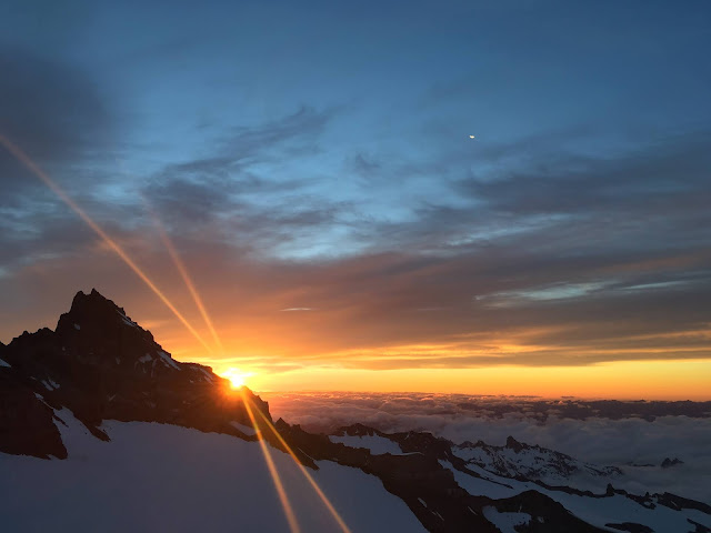
Sunrise from the Disappointment Cleaver. Always a sight to behold. 

DC Conditions Report

Rangers, guided parties, and independent climbers have been summiting the Disappointment Cleaver regularly via what is being called a "fast route". While not as straight up the mountain as the route was in early July, the current route is relatively straightforward and in good shape. Rangers climbed the route on 7/14 and noted these conditions. 

Camp Muir

Crevasses are starting to open up in the main camping area, so take a moment upon arrival to figure out where they are.  They are sometimes hard to discern due to the numerous bootprints across them, however, they do pose a hazard to unsuspecting climbers.

Camp Muir to Ingraham Flats: 

Leaving Camp Muir and crossing the Cowlitz Glacier follows a standard path. While trending east towards the rocks of Cathedral Gap there is an encroaching crack that is likely to push the boot pack higher on the Cowlitz. The late season crevasse that normally forms in a line around 10,400 and angles from the Cathedral Gap trail toward the Beehive is beginning to sag and show signs of opening soon. Rangers noted active rockfall all around the upper Cowlitz Glacier and across the last portion of the glacier before gaining the rock trail on Cathedral Gap. Further, while trending down the scree onto the Ingraham Glacier, the trail takes a low path onto an icy, watery, gravely mix of firma before getting onto the snowy bootpack.  Keep your headlight on a swivel through this section as well due to significant rockfall hazard from above. 

Camping areas and route on the Cowlitz Glacier as seen from the helipad, Camp Muir (7/10)

Ingraham Flats to Disappointment Cleaver: 

Once onto the Ingraham Glacier, the route follows a typical path heading up fall line towards the icy seracs of the Ingraham. Rangers found it appropriate to take a quick break around 11,200' to adjust before entering the objectively risky traverse from high crack to the cleaver. As the route reaches its high point on the Ingraham Glacier an icy snow bridge allows climbers to cross "high crack" and begin their traverse to the trail up the cleaver. Solid footwork and focus here are key. Having your team ready to arrest a fall or to belay across this could be a good choice for your group. On the high side of the crossing there is an anchor point that can be used as a running belay on the way down and it is advisable to take advantage of during the descent. The traverse to the rocks follows the usual route and, as always, is subject to ice and then rock fall. There have been reports of teams stopping to take breaks in this zone on the way down recently and we want to remind climbers this is an area to be efficient, if not quick, to move through as the objective risk is high here - especially as  as the day progresses. 

The upper Ingraham Glacier traverse from high crack to the cleaver. 

The Disappointment Cleaver

The path of least resistance up the cleaver takes you to the "Nose".  High on the Nose you will traverse climbers-left to a couple portions of deep boot pack through the snow and back onto the rocks toward the top. As always, heightened awareness under headlamp will keep you on route, on the best rock, and ease the travel for this portion of the route (its never harder than third class scrambling). Staying on route here diminishes the chances of creating rockfall caused by climbers inadvertently on the more exposed terrain or off-route. Rangers have noticed some parties remained spaced out on their rope teams through the cleaver, and we want to remind climbers to shorten your spacing through the rocky portions of the DC route to minimize the chance of your rope creating rockfall or getting damaged. 

Top of the Cleaver to the Summit

Above the cleaver, the route follows an angling left, then trending middle right line winding between areas of serac and crevasse-complexity. The number of switchbacks have increased since our last DC blog update, but the route does not take any circuitous jogs to end-run cracks as of this post. Around 13,100' a large crevasse is crossed using a fixed ladder section set at approximately a 70 degree angle. There are ropes on both sides which can be used as handlines to increase security. The boot pack on the upper mountain is becoming a deep and narrow trench in some sections. Rangers found it helpful to step out of the trench at times to ease travel and avoid snagging a crampon. 

Alpenglow on the upper mountain. From the top of the cleaver 7/14.

13,100' Ladder crossing. 

Descent

As a reminder, the heat dome of early July produced unprecedented effects on the mountain. While the route is getting climbed regularly, teams have been starting early to increase their safety on the descent. Snow bridges failing, crevasses opening, ice and rockfall are all standard hazards encountered on the DC route. With freezing levels above the summit for weeks now (following record high temps), these hazards only increase with exposure to the heat of the day. Have fun out there, Start early and Climb On!