Friday, July 31, 2020

E-W Route Update July 30th, 2020

As of Wednesday, July 29th the Emmons-Winthrop route remains largely unchanged from the last post on the 14th of July. Many parties have been reporting unseasonably light crowds and favorable climbing conditions. Crevasses remain easily navigable just out of camp, up the corridor and crossing back towards the Winthrop Glacier at 11,500’. Above this point, many of the larger crevasses are still holding together due to their thickness and the cooler temps up high.
View of the Emmons-Winthrop

Due to the bergschrund at 13,600’, most parties have been traversing climber's right at 13,400' and contouring all the way out to Liberty Saddle. Although this does add some time/length to the climb, the terrain is fairly secure and straightforward. From the Saddle, 800 feet of climbing will get you to the summit.

Although a few parties have been attempting to climb the Winthrop Glacier directly from Camp Schurman, recent icefall has swept the approach and many more looming seracs remain. Despite the fact that route conditions are holding together well for this time of year, minimal traffic and warming temps should keep parties leery of old boot packs and crevasse crossings. Parties should be prepared to assess the route and navigate new bridge crossings both on the way up and on the way down. 


Climbers and skiers approaching to Camp Schurman via the Inter Glacier will find that surface conditions are still quite planar and crevasses remain fairly closed up.  There are a few holes in convex terrain - make sure to see the entire run out before committing to a glissade on the descent.  Near Camp Curtis climbers are still traversing off of the Inter Glacier and onto the Emmons Glacier, then approaching camp from below.  

Over the past two weeks, parties willing to make the effort to climb to Schurman have been rewarded with sunny weather, stable climbing conditions and few crowds. Traffic has been light which allows for a unique climbing experience not always found on standard routes. 

Thursday, July 30, 2020

July 30th DC Update

The mountain's shadow confirming why it's called "Little" Tahoma

The DC route has not changed substantially since our last DC update -- please refer to the post from 7/20 for an in-depth update and also be sure to check out our Route Brief for all the fine details regarding this route. Warmer temps are in the forecast and have associated challenges such as weakened snow bridges and increased rock and ice fall. Be critical of snow bridges and move quickly through areas exposed to overhead hazard. High freezing levels will undoubtedly alter the route in the near future. Guide services will continue to work to keep the route viable, but come prepared to problem solve if a snow bridge falls through during your climb.  Enjoy the last bits of July up high!

Wednesday, July 22, 2020

Kautz Glacier Route Update 7/22/2020

The Kautz Glacier Route (and the nearby Fuhrer Finger Route) seems to have had about the same steady flow of independent climbers as a normal season - minus the few guided trips that make it over that way. There have been many successful climbs with climbers going up the Kautz and back down, or up and over to descend the DC. With the steady traffic, a couple of climbing rangers headed over to the Kautz to check on conditions.
View of the Kautz "Runway" where the two ice pitches lead to the top of the Wapowety Cleaver.
First off, a big thank you to the many climbers and skiers who have journeyed over here this summer; micro trash and human waste have been a huge issue in the past and we are happy that folks are taking Leave No Trace to heart. We hope this trend continues. Hikers and climbers: please leave the mountain nicer than how you found it simply by picking up any trash you find, even if it is not yours. Pack it in and pack more than it out.

While the Lower Nisqually approach is still looking relatively straightforward for this time of year, the rangers took the Comet Falls Trail through Van Trump to approach the route. There are a couple of snow patches on this approach below 5800 ft, but the snow becomes more consistent shortly above this elevation. So having some approach shoes (and shorts for the 14,000+ ft freezing level days) for this approach can be clutch. Where the rocky ridges have melted out some of the sub-alpine and alpine flowers have begun to blossom.
Joyful flowers on the approach through Van Trump.
There is water flowing by the alpine rock rings of the Upper Castle and by the top of the Turtle Snowfield near the 10,600 ft bivy sites. With the warm night temperatures we had, both water sources were still flowing strong in the morning. Remember, if you are building a new alpine rock ring site for this climb, you are working too hard and making an unnecessary impact. Please use the rock rings that are already established, there are more than enough for the number of permits issued in that zone.

From a distance the Kautz Glacier Route looked as though it had two long ice pitches. Turns out there is still sun cupped névé on the lower pitch which is criss-crossed with slim cracks (easy to step over). The upper, steeper pitch, is a mix of névé and alpine ice. The rock step to get from the top of the Turtle Snowfield to the ice pitches is about 10 feet high and a slightly tattered fixed rope is looking like it is still in usable condition.  Probably best to back this rope up with your own.

Traverse after the rock step to the two ice pitches on the Kautz Glacier Route.
Summer has finally arrived at Mount Rainier! The temperatures during the day have been hot and the night temperatures warm. The weather has been relatively stable with an occasional stronger than expected wind speed and low level marine pushes.  Planning appropriate departure and turn around times for your climb based on the temperatures is a must - don't be caught out on the upper mountain during the heat of the day!  And remember, if things aren't going right, if you are not feeling as strong as you thought, or the winds are more than they were predicted to be, don't be afraid to make the conservative call and descend. The mountain will be there for next time.

Climber out on a gendarme with Mount Adams in the background. 
We hope to see you up high and enjoying some of the more remote landscapes inside the park during what is historically the best weather week of the year!

Disappointment Cleaver Route Update 7/20/2020

All the cold June-uary and unseasonably cold start to July has made for outstanding conditions on the standard routes.  Here's some updated info on the DC:
Climbers descending above the cleaver.
Since our last blog update, some guiding has resumed on the Disappointment Cleaver. The path the route takes has not changed much in the last week, but with the added traffic and some hard work by the guides, travel conditions have greatly improved. The current route is well marked with wands and is relatively direct, especially for late July. A recent GPS track log measured the route to be 2.8 miles long from Camp Muir to the crater rim. There are two areas with "fixed" pickets at approximately 13,100'. These fixed pickets are for protection crossing above exposed crevasses on steep terrain - use them at your discretion and leave them in place as you pass. Aside from these pickets, there's currently no other fixed protection, fixed lines, or ladders on the route.

Exposed traverse above open crevasse. There are 2 fixed pickets in this section for protection.
Overall, the D.C. is in great shape. The lower half of the cleaver is melted out, and travel will be on rock, while the upper half is still snow covered. When traveling on the loose rock, make sure to use caution and avoid knocking rocks onto climbers below. 

The majority of the crevasse crossings on the route appear to be quite thick and well bridged. This could change with the above normal temperatures we are currently experiencing. When you are traveling on glaciers, be well aware of where you choose to take your breaks. Many flat areas that look like convenient stopping points are actually sagging crevasse bridges. Do not stop in these areas and definitely don't gather together or unrope in these places.

Track log from July 19th.

Saturday, July 18, 2020

NEOWISE Comet!

View of NEOWISE Comet over Seattle from Camp Schurman
The NEOWISE Comet has been blazing through the northwest part of the night sky over the last couple days.  Climbers on the Emmons-Winthrop have been able to view it just after sunset when looking above the light from the Puget Sound.  Astronomers have surmised it won't be back for another 6,800 years!  Check the latest route condition updates below and maybe add binoculars or an alpine telescope to your climbing kit this July.  See you on the mountain!

Thursday, July 16, 2020

Disappointment Cleaver Route Update 7/16

Suncupenitente Season

Suncups are bowl-shaped open depressions into a snow surface, normally wider than they are deep. They form closely packed, honeycomb, often hexagonal patterns with sharp narrow ridges separating smoothly concave hollows.

Penitentes, or nieves penitentes (Spanish for "penitent-shaped snows"), are snow formations found at high altitudes. They take the form of elongated, thin blades of hardened snow or ice, closely spaced and pointing towards the general direction of the sun.

The combination of the two, “Suncupenitentes” accurately represents the current conditions on the Muir Snowfield, particularly as one approaches Camp Muir.  Are they suncups? Or are the penitentes? Only a credentialed snow scientist would know for sure.  In any event, skiing is no longer recommended on the snowfield from the standpoint of sliding quality.  
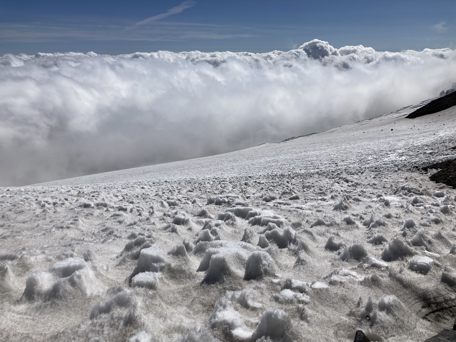
Suncupenitentes near Camp Muir, roughly boot top height
DC Conditions July 16, 2020
Presently, conditions up to Ingraham Flats and across to the Cleaver are largely unchanged from the July 7th conditions.  The current boot pack ascends from Camp Muir across the Cowlitz Glacier to Cathedral Gap, which is snow-free.  From the gap, ascend past Ingraham Flats and climb to "High Crack".  This crevasse runs in line with the flow of the glacier, and with the recent warm weather, this "trap-door" crossing is melting out and is thinly bridged.  Spend time examining this crevasse crossing.  With forecasted 15,000 foot freezing levels this weekend, thin snow bridges may remain soft overnight.  

The namesake Disappointment Cleaver has two primary options presently.  The Cleaver proper can be climbed directly on rock following the path of least resistance and obvious travel impact.  Alternatively, a route has been wanded in the snow on the west side of the ridge.  This starts approximately 1/3 the way up the ridge.  This terrain is highly suncupenitente’d. Approach this section with caution as any rockfall will funnel directly onto the climbing route below.  
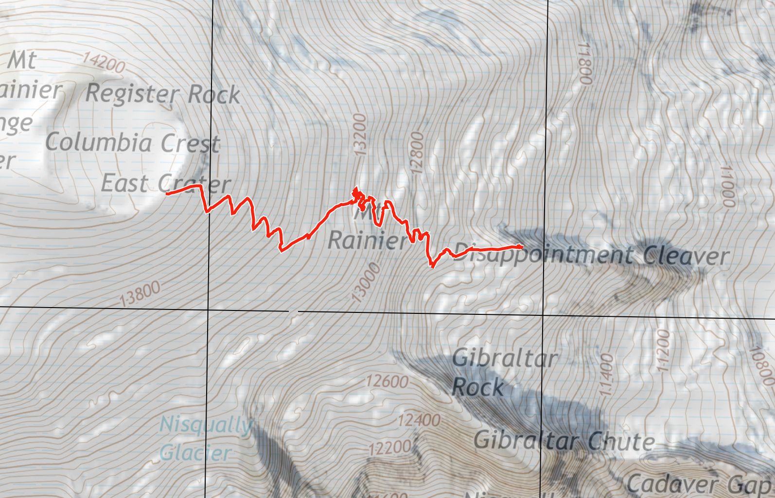
Once above the Cleaver, the route is now taking a more direct line than the Camp Comfort variation that has been taken in weeks past. While the Camp Comfort variation still goes, the crevasse hazards are growing and the terrain between the primary crevasses at 12,800ft and 13,500ft is steep and firm.  A fall without running protection could result in catastrophic consequences.  Both routes were wanded at the time of this writing so it is still possible to accidentally wander onto the Camp Comfort route.  A map with a recent track of the direct route can be found below.

Ultimately, the DC is still a remote and rugged route with very little traffic compared to a typical year.  Teams should not rely on another party’s wands for navigation.  Fe prepared and self-sufficient with GPS navigation and an emergency kit to survive 24 hours in a storm at high altitude.  


Recent track log of the direct variation (not the Camp Comfort variation)
12,800 foot crevasse hazard on the Camp Comfort variation