Thursday, July 11, 2019

Emmons-Winthrop Route Update July 8th, 2019


The Emmons-Winthrop route is in similar condition to the last post.  That being said, with the warm sunny weather as well as rain, the crevasses are opening up.

When departing Camp Schurman on your climb, there are two routes that leave camp.  The climber's right route takes climbers through a zone which has hollow bridges over crevasses, where the climber's left route avoids this hazard and maneuvers through a relatively benign crossing over a  small crevasse.

Climbers will have to manage a number of large, hollow crevasses when crossing from the football field to the base of the Corridor.  Move through this area with caution and spend adequate time assessing the condition of these crevasse bridges.

Once climbers reach 13,000', they are faced with a right hand route and a left hand route.  The left  hand route takes climbers directly under the burgshrund, then traverses to liberty saddle.  The left hand route also avoids weaving through hollow crevasses.

A few points for people planning on camping at Camp Schurman:

  • Spend time assessing tent sites around camp.  There are a couple large crevasses that are opening up very close to existing tent platforms.  
  • Please avoid camping on the rocks directly uphill from the ranger hut.  The National Park Service is trying to keep this area clear due to the proximity of the helipad.
Safe climbing!

Current route taking both Climber's left options.
Overview of current route

Looking up the Inter Glacier near Glacier Basin
Looking down at the approach to Camp Schurman from Camp Curtis
Moving through a crevassed area just uphill from Camp Schurman.
Thin bridge spanning a crevasse above 13k.
Route traveling parallel and directly over a crevasse above 13k. Note: this is taken from the climber's right track (notated in green on the photo.)  We recommend taking the climbers left route to avoid this and features similar.
Assessing to safely maneuver a crevasse bridge above 13k

Kautz Glacier Photos July 9th 2019

The Turtle Snowfield
On July 9th, while en route to Camp Muir, the park helicopter staff snapped some photos of the Kautz Glacier Route. Parties have been successful in reaching the summit via this route recently. The rock step to get onto the ice pitches is reported to be approximately 15ft tall.

View of the Kautz Glacier’s ice pitches
The upper Kautz Glacier

Tuesday, July 09, 2019

DC Route Update


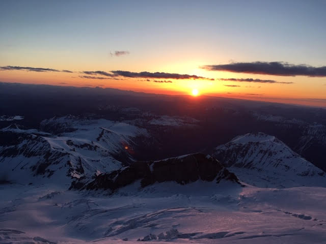
Sunrise from Muir Rocks 
The trail from Muir is punched in and well defined with all the holiday traffic and beautiful weather. Expect delays in bottleneck areas during the weekends and clear weather forecasts. As the crevasses open more, the trail continues to traverse them - avoiding large steps across where evidence of the old boot pack still exists. Follow the wands and newest boot pack away from the widest part of the crevasse. X'd wands mark old paths. 

Route view from Ingraham Flats
Heading up from Ingram Flats, the trail gains elevation to 11,400’ above a vertical crack before traversing down under the "Ice Box" onto the Cleaver. As you switch back up the Cleaver remember to shorten your ropes and tread lightly to prevent knocking rocks on climbers below.

Trail cut through penitents leading onto the cleaver

There are still some snow patches where the trail narrows considerably due to solar melt and foot traffic. At the top of the cleaver breath taking views are observed as the horizon extends far into eastern Washington. The top of the Cleaver is a great place to take a break. 

View towards Eastern Washington
From the Cleaver follow the trail alongside a 40’ tall overhanging ice wall leading into a short "stair case" chopped into the glacier. 

Traversing snow wall
At 12,900’ a snow bridge crosses a long traversing crevasse. This plug is above a long horizontal crack, where the trail crosses a flat ledge with snow steps on the far side. Use caution as this feature is thin. 

Snow Bridge at 12,900'
From 13,000’ up, there are several snow bridges, but these crevasses have fairly comfortable crossings. The rocky rim identifies the summit. A reminder that this is only half way, ensure there are still reserves for the trip down!

Route above DC

On your decent from one of the most spectacular views in Washington, remember to give crevasses the respect they deserve. Tread lightly on the cleaver and keep a smile on your face.

Friday, July 05, 2019

Muir Snowfield Update

Looking down the Snowfield from Camp Muir. Note the surface conditions.
It's been a slow start to the summer season, the stellar high pressure has yet to arrive and temperatures have fluctuated all over the place. Sadly, the unusually cool temperatures for the last couple weeks were not enough to help the lower mountain recover from the record high temperatures in spring. The snow pack at Paradise is sitting at about 3% of normal for July 5th (about 1 inch instead of the normal 38 inches).

The trails at Paradise are mostly clear until shortly before Glacier Vista. Then the snow gets patchy--and continues to be so until just past Pebble Creek, where it becomes all snow. Please be careful to step off the snow onto trail. Our beautiful alpine meadows easily get trampled during this transition period and Panorama Face is seeing severe erosion from people cutting corners.

And in terms of the skiing...well, don't come with high expectations and maybe consider leaving the skis at home. The sun cups are growing and there is a nice, thin, consistent dirt layer from Camp Muir down to Pebble Creek that will sandpaper the wax off your base. However, boot glissading is in its prime season now. It sure is nice to cut that extra weight off your feet this time of year and go light up to Muir. Don't forget to enjoy the view on your breaks.

Please remember, that weather changes fast up here on Rainier and the snowfield can quickly become socked in. Despite the boot track and things melting out, it is easy to become disoriented and lost on the snowfield when you are in a cloud. Please come with at least a GPS to navigate these conditions.

Thursday, July 04, 2019

Full camps!

The high camps (both Muir and Schurman) have basically filled up for Friday and Saturday nights.  Here's how it breaks down: There are 110 people allowed at Camp Muir each night.  There are 48 people allowed at Camp Schurman.

Camp Muir and the Muir Corridor
Currently, Camp Muir is FULL Thursday, July 4th, and Friday, July 5th.  Even for walk-up permits.  The only chance of getting a permit is if someone comes down early from their climb and checks out at the desk so that we can avail the numbers in the system.  It is likely that permits for Saturday night will all be taken up by early on Friday morning.

Common overflow areas for Camp Muir are the Muir Snowfield and Ingraham Flats.  There are 36 people allowed at each of those spots.  Right now the system shows limited availability for those sites.

Camp Schurman and the Emmons/Winthrop Corridor
Camp Schurman is also full for Friday and Saturday. The overflow area for Camp Schurman is Emmons Flats. There are only a few sites available at Emmons Flats and these are likely to be full shortly.

Single Push Climbers
All climbers are required to get a backcountry permit for their trip, INCLUDING single push climbing groups. If the campsites are all full along your intended route, then you will not be issued a climbing permit. Climbers found on the mountain without a permit will be turned around by rangers.

Resource Protection and Visitor Safety

The current limits on campers at each camp each night has been in place for a few decades.  These numbers represent the maximum limit of people that each area can handle with regards to resource protection and visitor safety.  For example at Camp Muir, when we have more than 110 people camping, the number of climbers on the route gets so large that it becomes unsafe.  Rockfall from climbers above, long wait times at pinch points or technical crossings, as well as lines for the bathrooms (and managing the human waste collection systems) can all reach un-enjoyable and un-sustainable conditions.  When the limits on the wilderness areas reach their maximum visitor's experiences aren't as fun or safe.  Please respect these limits.

Reservations

To make a reservation for the coming weeks and ensure a spot on the mountain, please visit this site.  About 60 percent of the total number of sites are available for reservation.  Please make your reservation two weeks in advance.  

Tuesday, July 02, 2019

Emmons-Winthrop Update 7/2/2019

Track Log from 6/30/2019


The Emmons-Winthrop route is in good shape as the season progresses, with a few places of note that Rangers encountered while climbing on June 30th.The first is the traverse above the Corridor. The route traverses climbers' right around two bulges of blue ice. This traverse, while not technical, would be consequential if a fall occurred. Parties might consider placing running protection through this section. As the snow melts, it will be difficult to protect this traverse without ice screws.

Possible variations at approx 13,100' on the Emmons Winthrop Route.  To the left is the steeper bergshrund crossing, and to the right is the easy traverse towards the saddle.
The next point of note is around 13,100'. The trail splits and some parties have been going climbers left and directly up the bergschrund. This variation is steep and may require two-tool climbing. The main route branches towards climber's right and traverses through much easier terrain towards the saddle and eventually the summit.

A large crevasse crossing at 13,500' on the Emmons-Winthrop Route.  In this photo the ranger has left the boot-track to utilize a safer snow bridge.
The weather has been changing rapidly on the upper mountain, ranging from thunderstorms to June-uary snowstorms! There has been 3" of new snow at Camp Schurman and up to 10" reported on the upper mountain in the past two days.  The new snow has complicated route-finding somewhat, so be prepared to choose your own adventure should you get the opportunity to re-establish the route!  It's been a good reminder that climbers attempting Mt. Rainier should be prepared for cold temps and decreased visibility regardless of what the month of the year may suggest.

It's beautiful up here, and we expect a busy weekend as folks come up during the long weekend.  Please remember to be prepared, tread lightly, and leave-no-trace during your visits to your National Parks this weekend!