Saturday, June 23, 2018

Disappointment Cleaver Update: No more ID

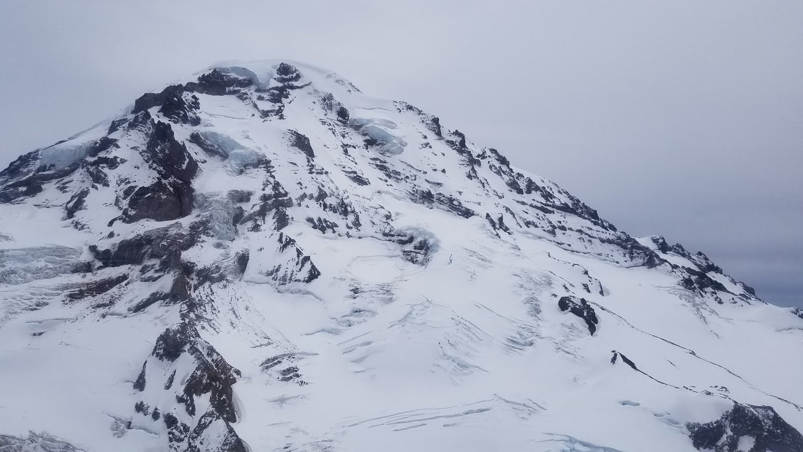
A photo of the Ingraham Glacier and Disappointment Cleaver from Ingraham Flats.


We knew it was coming... It looks like the Ingraham Direct is no longer viable for a summit attempt. A few intrepid teams have continued to use the route up the glacier but the guides have decided that the crevasse fall hazard is too great to continue traveling there.

The Cleaver is in fine shape, however, with snow and rock patches on the lower 1/3rd and steep snow switchbacks on the upper 2/3rds.

Climbers attempting the Cleaver are encouraged to practice rope travel techniques for both the glaciated and non-glaciated terrain they will encounter on the climbing route before they attempt a summit bid. The long rope intervals suitable for glacier travel are not appropriate on the rocky and steep sections of the Cleaver.

More info can be found the the NPS Route Brief for the DC.

Friday, June 22, 2018

Kautz Glacier Update

Many parties have been on the Kautz Glacier recently and are reporting mid-season conditions. Once below Glacier Vista and across the lower Nisqually Glacier, groups are using both “The Fan” and the Wilson Gully to exit the Nisqually onto the Wapowety Cleaver. Both options are in typical condition. Running water can be found near the top of The Fan on climber’s left. The ridge has moats and small glide cracks opening between 7800-8500’; give these a wide berth and consider keeping the rope on to reduce fall potential.

Dry (or mostly dry) campsites are available along the ridge and at The Castle (approx. 9500'). Reliable running water can be found at the Upper Castle. Most of the campsites above The Turtle and near the rock step are snow-free, but are devoid of reliable running water. Only use existing campsites; do not enlarge or create new sites.

From the high bivy sites, the route is in mid-late season condition. The rock step has melted out a lot in the past few weeks and requires care; consider scouting it the evening before your climb to come up with a plan.  The icefall zone between the rock step and ice pitches has been actively shedding very large chunks.  The ice pitches themselves are a combination of penitentes, smooth ice, and firm snow.  Careful of sun-rotted snow above firm ice.  This usually exists at the cusp of the ice and snow interface.  It's best if running out of rope near the top of the ice pitch to create an anchor in solid ice and then continue a second pitch well onto the glacier snow above than to try and run it out to the edge of the snow and find poor anchor ice and snow.  

Once above the ice pitches, the glacier offers a variety of options. Be prepared to navigate this section without an existing bootpack or wands. The exit off the Wapowety Cleaver around 13,000’ is holding up nicely and allows reasonable passage to the upper Nisqually Glacier. The upper Nisqually itself has numerous crevasse crossings and end-runs making solid glacier navigation skills necessary. Use of a GPS to log your path is recommended, in case of white-out conditions. There are few landmarks to navigate with and it is easy to become lost in this complicated glacial terrain.

Big thanks to Dallas for providing an update from his climb of the Kautz on June 22, 2018.  We always appreciate getting updated route reports and photos!  

Remember to pack out all of your trash and human waste from your climb. If carrying over and descending to Camp Muir, it is possible to drop off blue bags there, but all trash must be carried down to Paradise.

Tuesday, June 19, 2018

Ingraham Direct / Disappointment Cleaver Update

A climber end runs a large crevasse at 11,600' on the Ingraham Glacier

As of 6/19/2018 the Ingraham Direct is still the preferred route to the summit from Camp Muir. This is the longest the route has been viable in the 14 years that this ranger has been working on Mt. Rainier.

That said, the guides are prepping the Disappointment Cleaver for the eventual shift to that route. Most guides are now ascending the Ingraham in the night and descending the cleaver in the warmth of the day. This avoids crossing snow bridges when the snow is soft.

A lot of climbers are asking about the 'sketchyness' of the crevasse crossings on the Ingraham. This is obviously very subjective and each team will have to make their own risk management decisions when they get to the crossings. For an experienced team, using proper rope techniques, the crevasse crossings present much less of a risk than they do to a team using the rope improperly and certainly much less than an unroped climber.

Teams that are unfamiliar with heavily glaciated terrain should approach the Ingraham with utmost caution. Team fitness, weather conditions and snow surface conditions are all contributors to the sketchyness factor and should be taken into account throughout the climb.

Sunday, June 17, 2018

Father's Day Conditions on the Inter Glacier

 Lets start out with snow cover  --  

The Glacier Basin trail is snow free for approximately first mile and a half until you reach patchy snow.  Skiers are able to start skinning at the switchback below Glacier Basin, but have to take skis off for a small crossing above Glacier Basin.  From there it's snow all the way up.

A couple things to keep an eye out for when heading up the Inter Glacier --

Crevasses are starting to poke out as seen in the photo below, some of which are right next to the existing boot-pack and may be hard to spot until you're fairly close to them.  Keep an eye out and note their location for your descent.

Clouds move up the Inter Glacier up faster than you realize.  We recommend taking a track log with your GPS on your way up, that way if you loose visibility on your way down, you have something to go off of.

The Inter Glacier terminates at Steamboat Prow.  If you climb to the top of the Prow and wish to descend to Camp Schurman, you are faced with two options.  The first involves a loose, chossy down scramble through 4th class terrain with exposure.  This can prove difficult with a large backpack and mountaineering boots.  The second option, and the one we recommend, is to head to Camp Curtis (lower down on the ridge to the east) and descend up to the Emmons Glacier.  This involves roping up for a short hike up to Camp Schurman.  This option is much less technical but does involve glacier travel, so make sure to use proper rope techniques.


Sunken crevasse bridges adjacent to the existing bootpack.

8400' on the Inter Glacier

Hiking up through Glacier Basin with the snow melting quickly.

Clouds moving in on the Inter Glacier

Climbing the Inter Glacier around 8500'

Rough waypoints of crevasses beginning to open up on the Inter Glacier
Looking down the Inter Glacier towards Glacier Basin

Emmons Update, June 17th

Climbers ascending the Emmons into Camp Schurman with
 thunder cell development in the background.

Stormy weather and challenging route finding over the last few weeks have kept successful Emmons climbs to a minimum. Climbing rangers were stationed at camp Schurman over the weekend prepared to handle the large volume of climbers that were registered to climb. Once again, unsettled weather, cloud caps, high winds, thunder and lightening were the theme of the weekend. With relatively light crowds at camp throughout the weekend, it's assumed that many parties turned around before even reaching Schurman. As of Sunday afternoon, thunderstorms, white out and moderate winds continued to hamper upper mountain climbing conditions.


Cloud cap development was a theme of the weekend and prevented
 most parties from pushing above 11,600ft.
Of the many different guide groups and independent parties attempting the route in the last week, most reported firm surface conditions, lack of an existing boot pack and challenging route finding throughout the route and especially near the bergschrund. One party climbing on Friday morning was fortunate enough to have moderate temperatures, light winds and good visibility that presented a short window for a summit push. They described "end running" the 12,400 ft. to the climbers right, all the way out on the Winthrop shoulder.  This maneuver requires a long, uphill traverse from the top of the corridor and across numerous snow bridges. From there, the route climbs like it has in years past up the Winthrop shoulder and towards the bergschrund features around 13,400 ft. At this point, route finding will become a bit more critical as you work through crack systems up and North towards Liberty Saddle. The successful party reported traversing nearly all the way into Liberty Saddle proper before then ascending the crater to Columbia Crest.


Emmons glacier on Friday afternoon before storms rolled back in.
Notice the many parallel crevasses in the "alpine meadow"
between 11,800 ft. and 13,000 ft.
As of Sunday afternoon, many parties were staged at camp waiting for the weather to break and the predicted high pressure to move in. However, despite the forecasted warming trend, unsettled weather and chance of showers/thunderstorms may persist throughout the week. With that, climbers should be prepared for rapidly changing conditions throughout the course of their climb in terms of storm/cloud cap development, white out, poor visibility and challenging route finding. The lack of an established "bootpack" above 11,600 ft. will require sound glacial navigation skills and may necessitate a gps tracklog in order to find your way back down if conditions turn for the worse.


Saturday, June 16, 2018

General Conditions - June 15, 2018

The south side of Mount Rainier - June 11, 2018
The last week of mixed weather has brought a mix of conditions to Mount Rainier. Early in the week, snow fell below the elevation of Paradise. This shut down most climbing trips, but a few lucky skiers found mid-winter powder skiing conditions on the Muir Snowfield and Inter Glacier. This snow blew around, especially above high camps, and led to natural avalanches on steeper slopes. Crowns were visible on the Ingraham Glacier and other nearby features, clearly demonstrating unstable snow conditions. With warm weather forecast in the coming week, these slopes will be more prone to loose wet avalanches. Watch out for wet surface snow, pin wheels, and roller balls that can quickly entrain large amounts of snow.

On the White River side of the mountain, the trail into Glacier Basin is more dirt than snow and many are choosing to hike rather than ski on the approach. The Inter Glacier is starting to sport some open crevasses and the least broken line ascends on the climber's left side of the glacier near Mount Ruth. Strongly consider roping up on the ascent, especially if the light is flat or visibility is poor. Ensure that you can see the entirety of the runout if you choose to glissade on your descent. Glissading into a crevasse would be a terrible way to finish your trip!

The Emmons-Winthrop route has been seeing increased traffic over the past few weeks. The route remains largely unchanged and has a bootpack that is coming and going with fresh snowfall. As always, use a GPS to save your ascent track for possible use when descending in poor visibility later in the day.

Willis Wall - June 12, 2018

Carbon Glacier (Liberty Ridge in middle). June 12, 2018

Liberty Ridge has been shutting down all recent groups due to a combination of rockfall and complicated glacier travel on the approach. Snowfall last week and sustained winds likely built some sensitive avalanche conditions on the route also.

Mowich Face - June 12, 2018