Conditions on the Emmons Winthrop route remain favorable for climbing as summer stretches on. Rangers at Camp Schurman experienced a variety of mountain weather over the last several days. High freezing temperatures gave way to clouds, wind and even scattered upper mountain snow showers. To close out the weekend the Park saw thunderstorms, hale and heavy rainfall on 7/19.
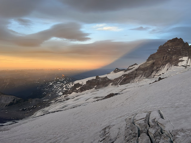 |
| 7/19/25 - Sunset on Little Tahoma |
Inter Glacier
The Inter Glacier continues to lose snow each day, no ice exposed as of 7/21. Hiking up climbers will find the transition to snow at around 7,000' elevation. Please follow the climbers trail to access the snow to avoid impacting the alpine vegetation. No cracks or holes in the Inter were noted.
 |
| 7/21/25 - A party begins ascending the Inter Glacier |
Emmons entrance from Camp Curtis
As the glacier recedes, the climb down from Camp Curtis to access the Emmons Glacier has gotten steeper with loose rock exposed. Use caution when making the transition on the descent and ascent of this feature. Use the appropriate travel techniques in this piece of terrain. Rangers watched multiple parties move through the steep rock step, maintaining traditional glacier travel techniques - a fall in this configuration could have serious consequences for the entire team. Teams should be prepared to slow down through here, coordinate with other groups moving through this bottleneck, and watch for rockfall. Some teams have opted to use hip belays in the steeper sections of the trail here, however there are no good rock anchors to rely on. As a reminder, after crossing the moraine the final approach to Camp Schurman is on the Emmons Glacier and climbers are encouraged to rope up for glacier travel. The boot pack crosses over several crevasses between the moraine and camp.
 |
| 7/19/25 - A party of 4 ascending up from the Emmons towards Camp Curtis |
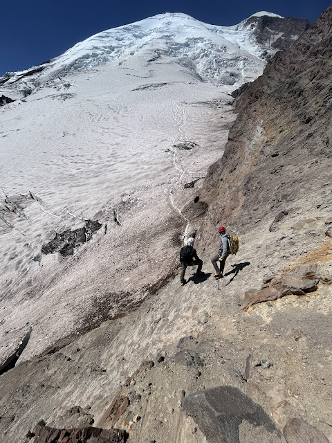 |
| 7/19/25 - The entrance to the Emmons from Camp Curtis |
Emmons Winthrop Route
As of 7/20 the route follows generally the same path as it has for the last couple weeks. The route has seen the most change between 11,400' and 13,000' as crevasses continue to open and re-routing of the boot pack occurs. This has led to several old, established boot packs existing in this section that led to dead-ends or less ideal crevasse-bridge crossings. Pay close attention through this zone and record a GPS track on your way up that you can follow back down to avoid wrong turns. Rangers noted with some route finding they were able to increase security over most crevasse crossings. Expect to encounter sections of exposed ice during your climb. Good crampon technique and potentially the placement of ice screws will alleviate exposure in these zones.
 |
7/20/25 - Broken Terrain on the Corridor at 10900'
|
 |
7/20/25 - At the top of the Corridor, 11400' - the current boot pack travels
through this feature.
|
 |
7/20/25 - 12250' on the Emmons route
|
 |
7/20/25 - 13600' the current boot pack traverses far climbers right to the Liberty Saddle with a few large crevasses to cross as you gain the saddle.
|
 |
| 7/20/25 - Sunset from Camp Schurman |


