|
| Sunset over Curtis Ridge from Camp Schurman |
Sunshine and warm weather returned to the mountain over the final weekend of June after a week of cooler temps and light precipitation. It was a busy weekend here at camp Schurman and many teams were able to take advantage of the great weather and find success on the Emmons-Winthrop route.
Warm weather and long sunshine of high summer change the mountain daily, so today's route beta may be tomorrow's dead end. Climbers who attempt the Emmons-Winthrop route should come prepared for an unmaintained, wilderness glacier route which requires diligent navigation, careful crevasse-bridge assessment, and self-sufficiency in a remote, alpine environment.
The trail from White River campground is 99% snow free to Glacier Basin and above till reaching the Inter Glacier near 6800'. Travel up the Inter is mostly snow and no crevasses have appeared yet along the standard boot pack.
 |
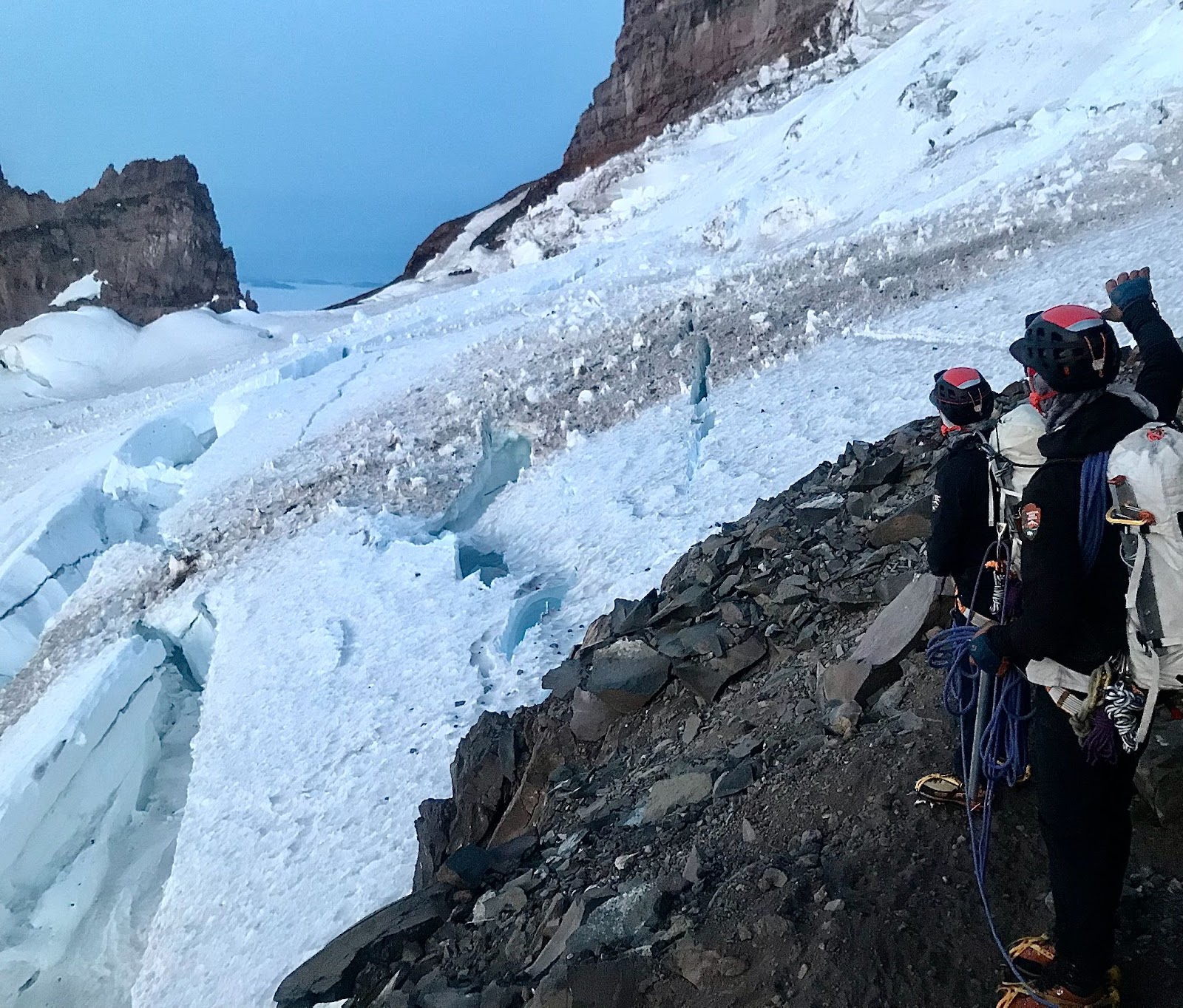
| Steep, loose dirt and rock crossing the moraine from Camp Curtis to the Emmons Glacier below Camp Schurman (6/30/25) |
 |
| The final step of the moraine before getting on the Emmons Glacier (6/30/25) |
Accessing the Emmons Glacier from Camp Curtis has become increasingly difficult now that the moraine is mostly snow free, exposing steep, loose rock and dirt. Teams should be prepared to slow down through here, coordinate with other groups moving through this bottleneck, and watch for rockfall. Some teams have opted to use hip belays in the steeper sections of the trail here, however there are no good rock anchors to rely on. As a reminder, after crossing the moraine the final approach to camp Schurman is on the Emmons Glacier and climbers are encouraged to rope up for glacier travel. The boot pack crosses over several crevasses between the moraine and camp.
 |
| Approximate path of the Emmons-Winthrop Route 6/30/25 some extra switchbacks may be encountered |
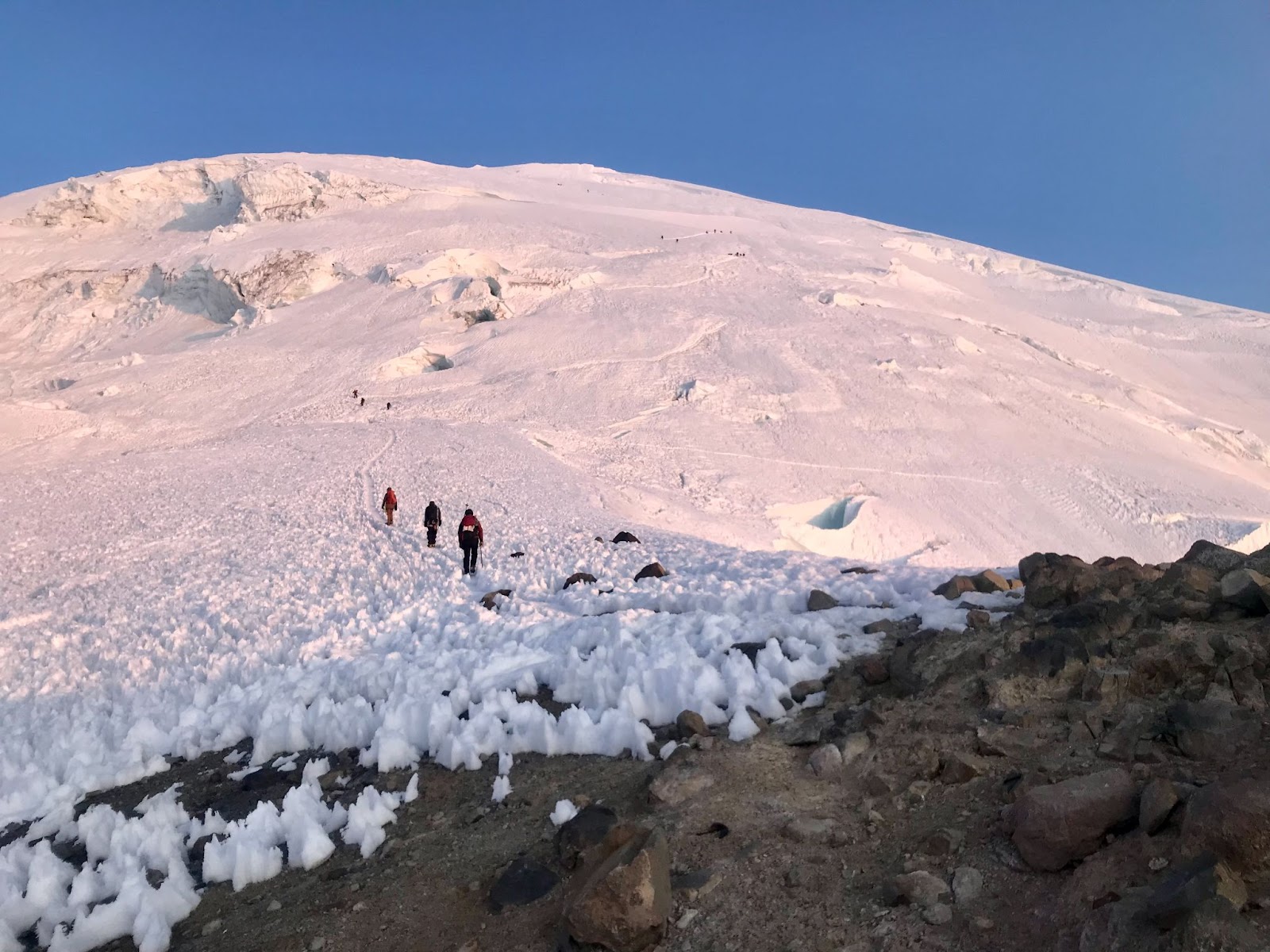
As of 6/30/25, the route remains in good condition and follows generally the same path as it has for the last couple weeks. The route has seen the most change between 11,400' and 13,000' as crevasses open and re-routing of the backpack occurs. This has led to several old, but well-established boot packs existing in this section that lead to dead-ends or less ideal crevasse-bridge crossings. Pay close attention through this zone and record a GPS track on your way up that you can follow back down to avoid wrong turns. When in doubt it, teams have reported that taking the lower boot pack option has been more successful if multiple trails are present.
 |
| Widening crevasse near 12,400'. The boot pack may or may not be the best place to cross when you encounter it (6/28/25). |
Teams are encouraged to evaluate each crevasse crossing they encounter along the boot pack as often there is a much better place to cross just downhill or uphill of where the established boot pack is. In some cases, the crevasse may be end run entirely just a short distance from the boot pack so be sure to look around instead of blindly following the trail. Bridges that may have been solid in the AM can often be unreliable by midday after the sun and heat has softened the snow up, so teams should make a plan to be down early and stick to preset turnaround times.
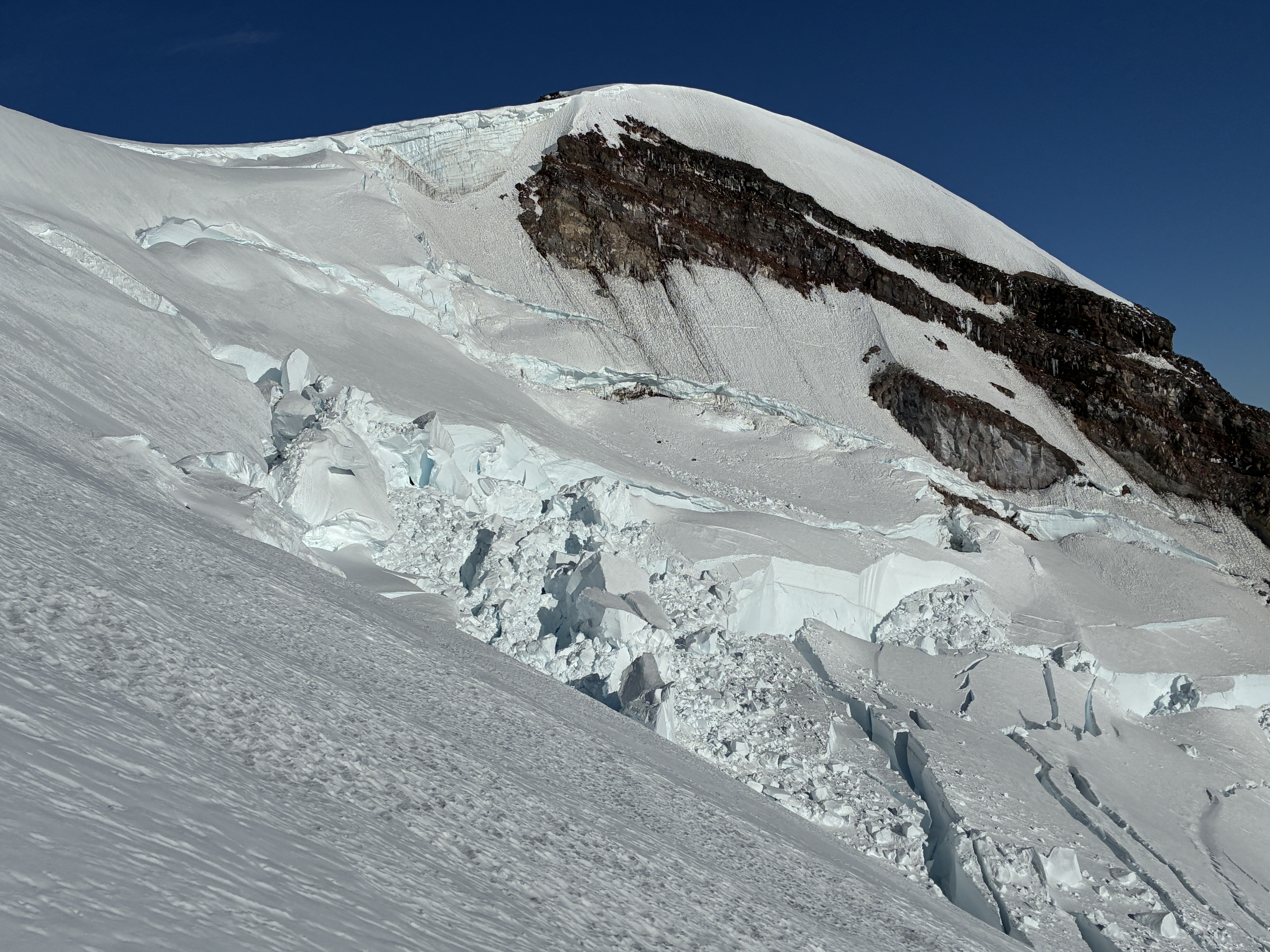 |
| Large serac fall in the gut of the upper Winthrop glacier. The route traverses above this to/from the Liberty Saddle (6/28/25). |
Don't forget to pay the climbing cost recovery fee and check in out our wilderness information centers at Paradise or White River entrance to receive your climbing permit in person. This is a great time of year to be on the mountain with long days and pleasant weather, we look forward to seeing you up here!
Also, check out our last couple blogs on the Emmons for additional info.


.jpg)


.JPG)
.jpg)
.jpg)